Warm and tranquil weather into the late week
Look for cool mornings to continue along with pleasant afternoons
It’s been a fantastic final week of August weather-wise across Central and eastern Kentucky so far and Wednesday was no exception. We saw record low temperatures once again in many locations, including Lexington which dipped all the way down to 46 degrees, besting the record of 49 set back in 1968. Once the sun came up we saw a quick warm-up thanks to lots of sunshine and high pressure sitting right overhead. This pushed afternoon highs into the mid to upper 70s so it was another amazing day to be outside.

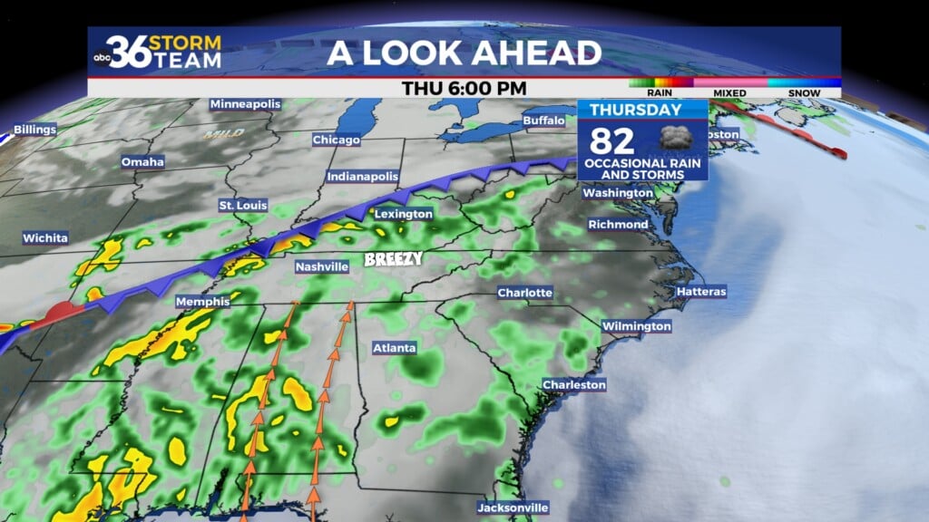
Heading into Thursday, the area of high pressure will begin to drift to our east but our weather should stay unseasonably mild. Record low temperatures look possible yet again as morning lows drop into the upper 40s to around 50 degrees. A wave of energy should be sliding by to our south, which could through a few more scattered clouds into our southern counties but overall it looks to be another banner day with mostly sunny skies and afternoon highs creeping back toward the 80 degree mark to go along with very low humidity levels, especially for the end of August.


By Friday a weakening frontal boundary will drop through the Ohio Valley but the existing dry air over the commonwealth should prevent any isolated storms from firing up. Temperatures should warm up a bit more with afternoon highs in the low 80s, which is just a few degrees below average for this time of the year. We should see a reinforcing push of dry and milder air heading into Labor Day weekend so temperatures may actually back off a few degrees into Saturday with upper 70s to around 80 degrees expected for afternoon highs. This will mean ideal conditions for any outdoor holiday plans in addition to a perfect afternoon for Kentucky’s kickoff to the 2025 football season as the Cats take on Toledo at Kroger Field. Just remember to hydrate and wear plenty of sunscreen, especially if you are going to be in direct sunlight for any length of time.


The second half of the holiday weekend should stay warm and dry although the model data isn’t fully synced up with keeping the isolated storm chances away heading toward Labor Day and the kickoff to September on Monday. There is the potential that enough moisture creeps northward from the south to trigger a few isolated storms during the warmth of the afternoon but the majority of the models hold that off so at this point look for the extended stretch of dry weather to continue into early next week as afternoon highs climb back into the low to mid-80s.

ABC 36 Storm Team 36-Hour Forecast:
Wednesday Night: Mostly clear and cool, near record lows possible. Lows in the in the upper 40s and low-50s. Wind: SE 5 mph.
Thursday: Mostly sunny and warm. Highs in the upper-70s. Wind: W 5 mph.
Thursday Night: Mostly clear and pleasant. Lows in the mid-50s. Wind: W 5 mph.