Warm this weekend but nice changes are on the horizon
We'll get an early preview of fall next week
After starting the day with some stubborn low cloud cover, a bit of sunshine returned through the day across Central and Eastern Kentucky as we closed out the week on Friday. The early lingering clouds did slow the warming process down a bit so most locations ended up with afternoon highs in the mid-80s, which is right around average for late August. With high pressure in control, the weather cooperated as the 2025 high school football season kicked off across the commonwealth.
Heading into the weekend it should be a warm Saturday with some sunshine and a bit more humidity as a cold front approaches from the northwest. It should be a good day for outdoor activities but you’ll definitely want to hydrate and load up on the sunscreen as afternoon highs reach the upper 80s with the muggy air making it feel a bit warmer than that. There is the chance of a few late day scattered storms but these don’t look to be widespread so just take the rain gear along to be on the safe side.
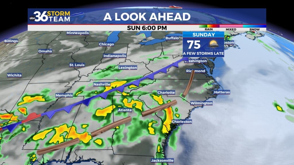
The aforementioned front will slowly make its way across the commonwealth as we close out the weekend on Sunday, keeping temperatures on the warm side across the board. Look for afternoon highs in the mid-80s here in the Bluegrass with more sunshine around and upper 80s with a few scattered storms possible in the mountains of Southeastern Kentucky as the boundary presses eastward. This front will usher in a major pattern change into next week as we get a sneak peek of the fall season. You should really feel the difference out the door on Monday morning as humidity levels drop off significantly and cooler, drier air arrives. Early morning lows should be in the mid to upper 50s Monday with afternoon highs in the upper 70s along with full sunshine so it should be an amazing start to the week.
It’s going to feel more like late September much of next week as an unusually start area of Canadian high pressure settles into the Ohio Valley. You’ll finally be able to give your A/C a break as we see an extended stretch of very pleasant weather across the board. Look for early morning lows all the way down into the low 50s through the mid-week with afternoon highs only reaching the mid to upper 70s, which is a solid 8 to 10 degrees below average for the end of August! With abundant sunshine around and no humidity in play, it will feel simply fantastic as we stay high and dry throughout the work week. Afternoon highs will moderately slowly as the low 80s return heading toward Labor Day weekend.
ABC 36 Storm Team 36-Hour Forecast:
Friday Night: A few clouds and pleasant. Lows in the mid-60s. Wind: NE 5 mph.
Saturday: Mostly sunny and warm, a few isolated P.M. storms. Highs in the upper-80s. Wind: W 5 mph.
Saturday Night: Partly cloudy, a stray storm possible. Lows in the mid-60s. Wind: NW 5 mph.


