Flash Flood Threat Continues Sunday
Heavy rain could bring 3–4 inches in spots before heat and humidity build later this week
Flash Flooding Threat Continues Through Monday
A Flood Watch remains in effect through 8 PM Monday for most of central and eastern Kentucky, where the ground is already saturated from recent heavy rainfall. Be alert if you’re in low-lying or flood-prone areas — especially near creeks and streams that respond quickly to intense rainfall.
Showers and storms continue to roll across central and eastern Kentucky this afternoon, and the risk for flash flooding remains a big concern. A very moist and unstable airmass is fueling these storms, and some are becoming better organized—especially with a cluster dropping in from southern Ohio. Rainfall rates of 1.5 to 2.5 inches per hour are possible, and localized totals of 3 to 4 inches or more can’t be ruled out where storms repeatedly move over the same areas. Along with the heavy rainfall, we do have a chance of seeing some pretty gusty winds along with any storms that develop.
With flash flood guidance already low in parts of eastern Kentucky, it won’t take much for creeks and streams to rise quickly. Flooding will be especially dangerous in poor drainage spots, hollows, and hilly terrain where runoff happens fast. If you live in a flood-prone area, keep an eye on the radar and have multiple ways to get warnings.
Storms Continue Into Monday, Then Fewer Rain Chances
More rounds of showers and storms are possible through tonight into Monday, with the potential for training storms to set up again. Some areas could pick up 2–4 inches of rain, which may lead to scattered flash flooding or even significant flooding in the hardest-hit areas. Gusty winds and frequent lightning will also accompany the strongest storms.
By Monday evening, storms will gradually shift farther south and taper off for most of the region.
Heat and Humidity Take Over Next Week
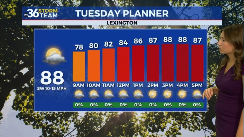
Starting Tuesday, the weather pattern begins to change as a stronger ridge of high pressure builds in. That will help cut back on rain chances—though an isolated afternoon storm can’t be ruled out—but the trade-off will be hotter and more humid weather.
Afternoon highs will climb into the upper 80s and lower 90s, and with dewpoints in the 70s, heat index values will feel more like 100 to 105 degrees by midweek. Make sure you’re taking precautions if you have outdoor plans during the hottest part of the day.