The heat returns as our storm chances ramp up into the mid-week
A few of the storms could be on the strong to severe side, especially areas east of Lexington Wednesday afternoon
We enjoyed a quick break from the hot and muggy weather to begin the week but Mother Nature gave us a rapid reminder that we are in late June and summer has just started as the hot and humid air came pouring back in on Tuesday. Afternoon highs spiked back up into the upper 80s and low 90s but luckily humidity levels weren’t off the charts even though they were elevated. You could really feel the difference if you were out and that heat and moisture will be a big player heading into the mid-week as a cold front drops into the region.

Things have been pretty dry of late across Central and Eastern Kentucky so we could really use some decent rainfall. The aforementioned front will help provide that as it dives through the commonwealth on Wednesday. The latest data has a few scattered storms Wednesday morning with the main action coming along the front through the afternoon hours. The overall severe threat has increased some as now there is a Level 2 severe risk (out of 5) for areas to the east of Lexington with the rest of the commonwealth under a Level 1 threat. With the parent low being a little farther south this puts the isolated spin-up tornado in play in the Level 2 risk area (see the map below) with damaging winds being the primary threat across the board. Afternoon highs should make the upper 80s before we cool down a bit with the expected storms in the area.


We have shifted into this pattern of heat, then a cold front moving through with storms, followed by a brief respite with more moderate temperatures and less humidity…albeit briefly. This is what we are looking as we finish out June and head into July early next week. Expect a drier Thursday on tap with lower humidity levels and afternoon highs right around average in the mid-80s. By Friday, the heat will quickly return along with some humidity as afternoon highs jumping back into the low 90s.


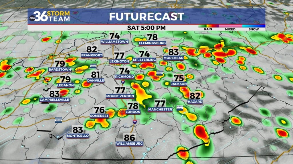
Another front will make a run into the Ohio Valley late Saturday and into Sunday so expect another round of showers and storms although with the potential of a few strong storms. The “muggy-cast” definitely reflects the overall pattern with the “roller-coaster ride” look as we bump humidity levels down behind each departing system before they surge ahead of the next one. Some of the data is showing some decent rain totals between now and the end of the weekend, which we’ll definitely take give the overall drier pattern of late. Another shot of moderate air and less humidity should briefly greets us as we welcome July next Monday.


ABC 36 HOUR FORECAST
TUESDAY NIGHT: Warm and muggy with isolated storms. Lows in the low-70s.
WEDNESDAY: Scattered storms, some strong. Highs in the upper-80s and low-90s.
WEDNESDAY NIGHT: Storms ending, drying out. Lows in the mid-60s.