A quick break in the damp weather pattern heading into Thursday
We should squeeze some sunshine before the next storm system arrives quickly to end the week.
With an area of low pressure spinning right over the heart of Central and Eastern Kentucky on Wednesday, we saw a damp and dreary day with occasional rain and some thunder as well. The rain was pretty heavy in spots here in the Bluegrass early in the morning and combine that with little to no movement of the rain with those spots being right underneath the low, and the end result was some high rainfall totals and some minor flooding issues along some of the smaller streams and creeks just northwest of Lexington. The rest of the day saw hit and miss showers with the clouds holding temperatures into the upper 60s and low 70s for afternoon highs. Below is a look at some of the higher rain totals Wednesday morning from some of the Kentucky Mesonet sites.

We’ll do the ole “squeeze play” on Thursday as the Ohio Valley will be in between storm systems so expect a return of some sunshine and warmer temperatures. Afternoon highs should feel pretty nice as they top out in the upper 70s but it will be a short window of tranquil weather as some of the data is indicating a few showers and storms could return as early as late Thursday evening. I think the daylight hours will be dry with some increasing clouds late in the day.

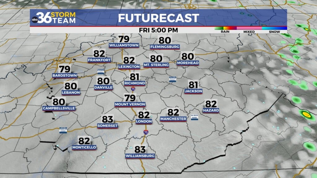
Unfortunately the end of the week and the start of the weekend look wet and stormy again as a couple of waves of low pressure slide through the Ohio Valley. This will mean basically a repeat of what we have just seen with occasional rain and storms along with some heavier downpours. At this point the overall severe threat looks low for Friday, although the Storm Prediction Center does have a good chunk of the area in the Level 1 risk (out of 5) with some damaging wind gusts possible if we manage to see a few strong storms. Of course we’ll keep an eye on it. The rain and storm chances hang around Saturday as the secondary low spins through so unfortunately the weather looks to have an impact on the 2nd and 3rd rounds of the PGA Championship happening at Valhalla outside Louisville through the weekend.


A nice warm-up looks to be on the horizon as temperatures start to climb beginning Sunday and continuing into early next week. Our storm chances should be very low end during that time frame with just an isolated to scattered storm mainly during the afternoon and evening hours Sunday through Tuesday. Afternoon highs will climb from the low-80s into the mid-80s by Tuesday, which is above average for this time of the year. More unsettled weather could be on the way by the middle of next week.

ABC 36 HOUR FORECAST
WEDNESDAY NIGHT: Showers taper off, clearing late. Lows in the mid-50s.
THURSDAY: Mostly sunny, clouds increase late. Highs in the upper-70s.
THURSDAY NIGHT: Mostly cloudy, showers and storms return. Lows in the low-60s.