Additional rain chances ahead
Meteorologist Jordan Smith has a look at your Friday forecast!
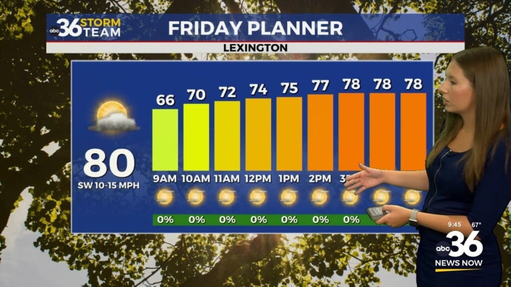
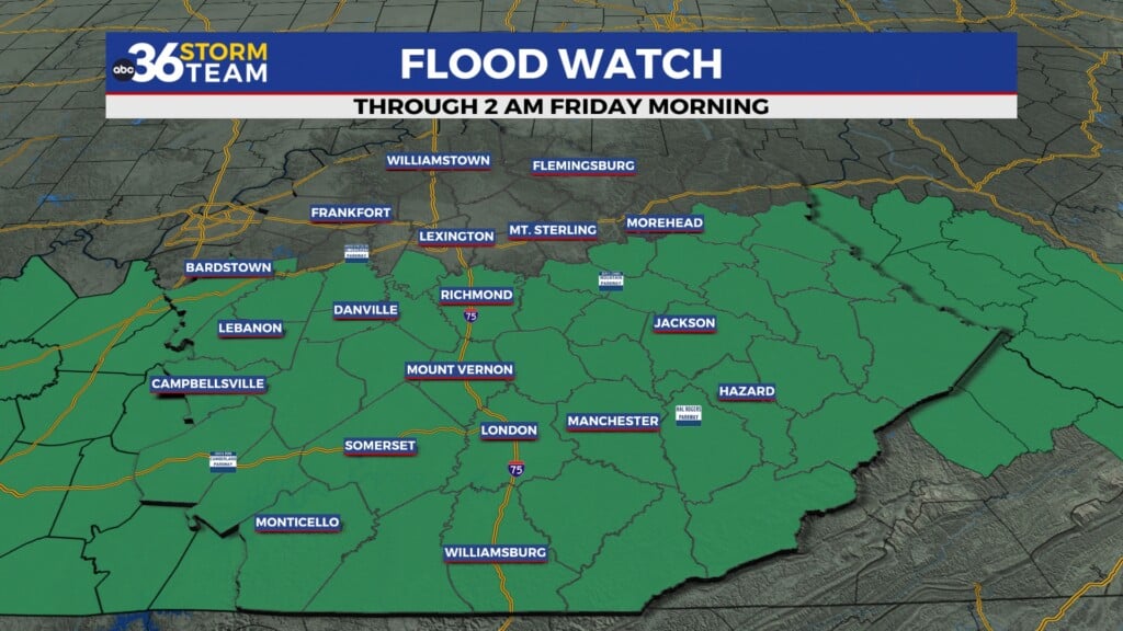
Lexington, Kentucky (WTVQ – ABC 36): Good Friday everyone, it is a wet and rainy day across central and eastern Kentucky. But we need all the rain we can get with the ongoing drought conditions. Rain will turn into scattered showers for the afternoon with highs in the mid to upper 50s.

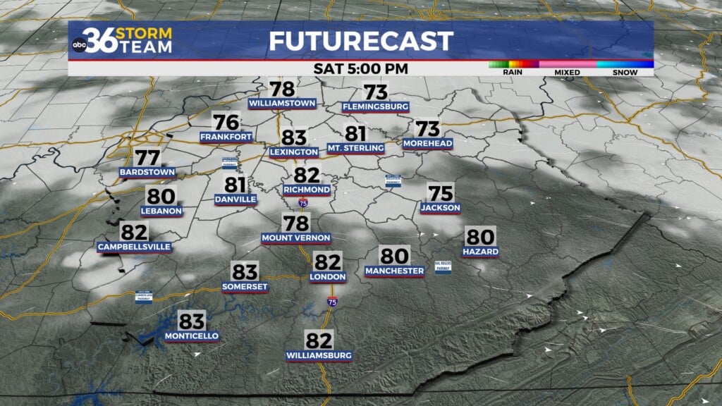
Saturday looks mainly dry but we will still be tracking scattered showers, especially in eastern Kentucky. Highs will be back into the mid to upper 50s.

Rain will become likely once again Sunday morning with moderate to heavy rain possible for a time, very similar to this (Friday) morning.

Once again, similar to today, we will go to just a scattered shower into the afternoon with mid to upper 50s.

Rain fall totals now – Sunday look to be lighter here in central Kentucky compared to southern and eastern Kentucky. That is great news though because these areas are experiencing the most drought conditions.

Monday and Tuesday will see high temperatures coming down into the upper 40s with a couple light rain systems dropping in from the northwest. Neither day is a wash out by any means.

Temperatures turn cold again for next Wednesday with possible rain AND snow showers!

ABC 36 HOUR FORECAST
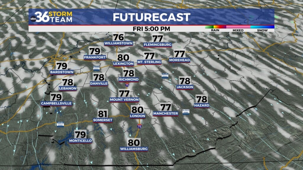
FRIDAY: Steady rain turning into scattered showers. Highs in low-to-mid 50s.
FRIDAY NIGHT: Mostly cloudy with isolated showers. Lows in the upper 40s to low 50s.
SATURDAY: Partly cloudy with a few showers. Highs in the mid-to-upper 50s.