Storms return before we dry out to end the week
Heavy rain and gusty winds are possible as the storms roll through Wednesday night and into Thursday.
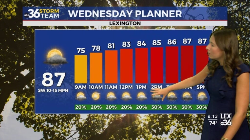
We’ve enjoyed a couple of fairly quiet days through the mid-week weather-wise here in Central and Eastern Kentucky as weak high pressure drifted through the region. Thanks to a good bit of cloudiness mixed in with some sunshine, afternoon highs were held in check a bit but were still comfortable for early August with temperatures topping out into the low 80s. Hopefully you’ve enjoyed our brief break from the wet weather as out storm chances ramp up Wednesday night and into Thursday.

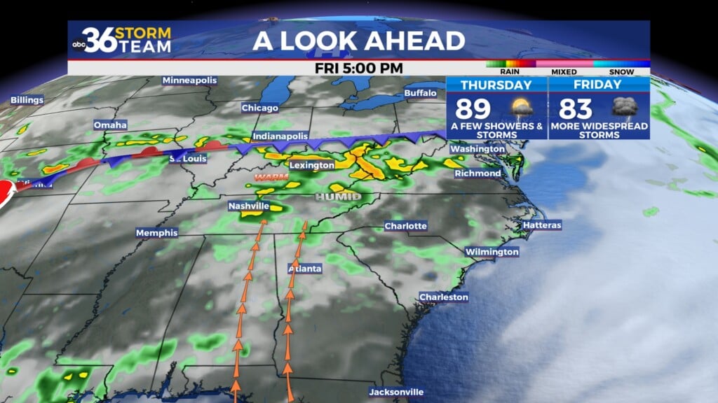
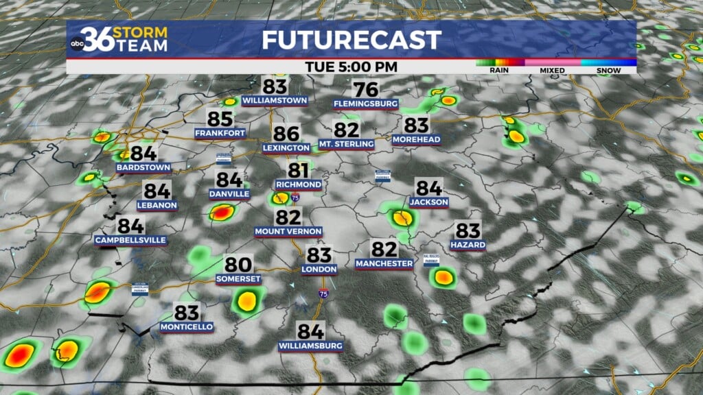
With a wave of low pressure sliding along a stationary boundary to our south, showers and storms will pick up through Wednesday night and continue into Thursday with the heaviest rain expected to be across Western and Southern Kentucky. This is also where the best chance of a few strong storms will be possible although the higher threat has been pushed even farther to the southwest with Lexington westward in a low end Level 1 severe risk into the early hours of Thursday. Gusty winds and heavy downpours are possible with the bulk of the activity winding down the deeper we get into Thursday. Afternoon highs will be held in check into the low 80s given the clouds and the rain around, especially early in the day.


Quiet weather is expected on Friday as another weak area of high pressure builds in so it looks mainly sunny with highs in the upper 80s to close out the week. Our active weather pattern will continue into the weekend with another boundary moving in so more scattered storms will be possible. It shouldn’t be a washout at all, although Saturday looks to have better storm chances than Sunday. The other part of the equation is the hot and muggy air expected with highs around 90 degrees each day and a bit of humidity around.


Yet another cold front, this one a bit stronger will dive through the Ohio Valley on Monday so more showers and storms will be on the table. We’ll have to keep an eye on the potential for a few strong storms with that system. The good news is that once the front clears we should enjoy an unseasonably nice stretch of weather into the middle of next week with sunshine, lower humidity levels and highs into the upper 70s and low 80s!

ABC 36 HOUR FORECAST
WEDNESDAY NIGHT: Breezy with scattered rain and storms. Lows in the upper-60s.
THURSDAY: Showers and storms, ending late. Highs in the low-80s.
THURSDAY NIGHT: Mostly clear and quiet. Lows in the mid-60s.