A break from the unsettled and active weather pattern is on the horizon
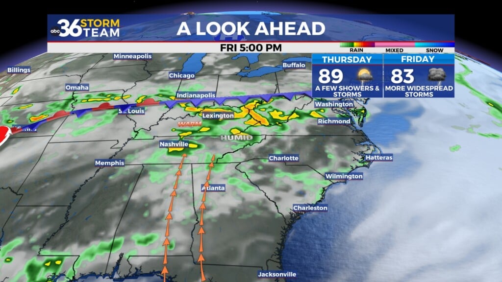
Overcast skies kept things quiet Thursday but more strong to severe storms are possible Thursday ahead of a cold front.
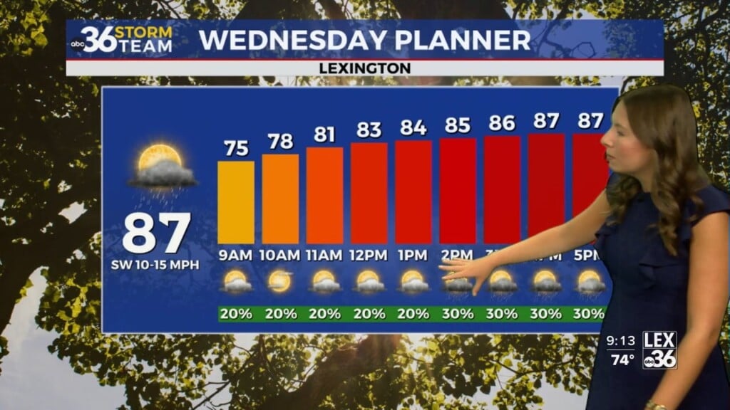
It was a much quieter day of weather across Central and Eastern Kentucky on Wednesday, especially compared to the stormy and active day we had to deal with Tuesday. The low to mid-level clouds cover kept things overcast much of the day holding afternoon highs into the upper 70s and low 80s in most locations. Those clouds were associated with an area of rain across far Western Kentucky which caused some historic flash flooding in Mayfield in Graves County, the same area that was devastated by the strong tornado that moved through on December 10, 2021. Unfortunately the city was front and center for 8″-10″+ of rainfall in less than 12 hours, which caused major problems and put many neighborhoods under water.


Heading into Thursday a cold front will make a run into the Ohio Valley, increasing our chances for more showers and storms across the area. The model data continues to bounce around with the timing and placement of any potential storms so that’s something we’ll keep an eye on. Timing is critical in that any morning storms Thursday could help to hold things in check for the afternoon, whereas a dry and sunny morning would set the stage for more organized strong to severe storms later in the day. Right now the Storm Prediction Center has basically all of Central and Eastern Kentucky in a Level 2 sever risk (out of 5) with damaging winds, large hail and heavy rain being the primary threats. It’s a tricky forecast to say the least so keep an eye on the weather Thursday.

The much advertised delightful weekend is still on tap for the commonwealth as the cold front pushes south of the area on Friday. This will allow high pressure to drift in from the northwest bring drier air and more importantly, less humid air to the region. It’s the rare occasion where it times up in late July over a weekend to get highs into the low to mid-80s, lots of sunshine AND the lack of humidity. Our “muggy meter” shows the nice break that is on the way before we climb back into the upper 80s with more typical summer conditions early next week.


ABC 36 HOUR FORECAST
WEDNESDAY NIGHT: Warm and muggy with a few storms. Lows in the upper 60s to around 70.
THURSDAY: Rain and storms, some strong. Highs in the mid-80s.
THURSDAY NIGHT: A few isolated storms, still warm. Lows in the upper-60s.