A cool start to the week for mid-June but warmer days return soon
Temperatures struggled to get out of the 60s Monday behind a departing cold front
After a wet and stormy finish to the weekend with severe storms causing wind damage and up to tennis ball sized hail in Southern Kentucky along with several rounds of heavy rain here in the Bluegrass, we saw a much cooler day on Monday with conditions feeling more like early May instead of mid-June. With cooler air in the wake of the departing front, it felt more like early May instead of mid-June as afternoon highs struggled to reach the 70 degree mark under a mix of clouds and sun along with a cool west wind. Check out some of the damage and large hail pictures from the storms down south on Sunday.


An upper level low will hang over the Great Lakes into Wednesday, keeping breezy conditions and slightly below average temperatures in place. While we should remain dry with the low to our north and a stalled out front to our south, winds will gust 20 to 25 miles per hour at times but with more sunshine around, afternoon highs should recover into the mid-70s for most spots.


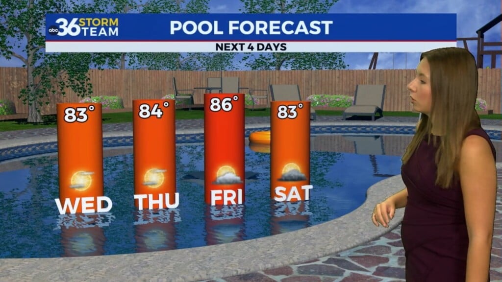
As the upper low pivots to the east on Wednesday and begins to exit the area, a weak boundary on the south side of it should rotate through the Bluegrass Region so a few isolated to stray showers look possible along and north of the I-64 corridor. The rest of the area should be dry with as highs climb back into the upper 70s. High pressure will be building in for the late week with more sunshine and highs climbing through the 80s so it should feel much more like summer by Thursday and Friday.

Looking ahead to the upcoming weekend, a few waves of energy should slide through the Ohio Valley, keeping the daily scattered storm chances in the picture. While it shouldn’t be an all day rain by any means, you may have to adjust your plans accordingly depending on where the storms pop up. Afternoon highs should remain mainly in the low to mid-80s depending on clouds and storms as we head through the Juneteenth holiday next Monday.

ABC 36 HOUR FORECAST
MONDAY NIGHT: Clearing out, a bit cool. Lows in the upper 40s and low-50s.
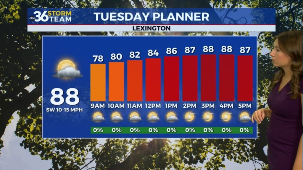
TUESDAY: Mostly sunny and breezy. Highs in the mid-70s.
TUESDAY NIGHT: A few clouds, still breezy. Lows in the upper-50s.