More Sun For Sunday
We had a bit of hazy sun today. That is a start. We should be rain-free through next week. Tomorrow (Sunday) early could see light snow in southern, southeastern KY. We should see more sun Sunday.
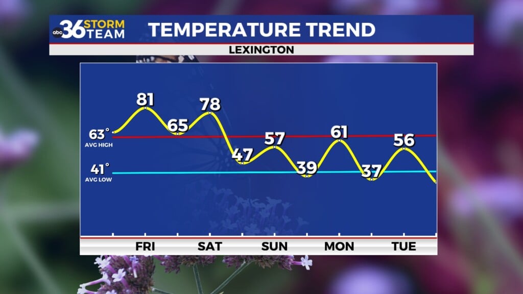
Tonight: Cloudy and cold. North winds light and a low of 27.
Sunday: Mostly sunny and a high of 48. Our far southern and southeastern counties could see light snow early Sunday.
Monday: Mostly sunny and a high of 50
Tuesday: Partly cloudy and a high of 57.
Wednesday: partly cloudy and a high of 61.
Thursday: partly cloudy and a high of 59.
Friday: Partly cloudy and a high of 63.
Saturday: Partly sunny and a nice high of 67.
Sunday: a 40% chance of showers and a high of 65
*Today in weather history
Lexington’s record high for today is 76 degrees set in 1944.
A three-day “heatwave” for eastern KY in 2000. The London-Corbin Airport hit 77. The record still stands at 81. 76 and 78 degrees the 25th and 26th respectively at the Jackson NWS office
|
1972 – The Buffalo Creek disaster occurred in the Buffalo Creek Hollow of Logan County in West Virginia. A coal slag dam on the Middle Fork of Buffalo Creek burst sending a fifty foot wall of water down a narrow valley killing 125 persons and causing 51 million dollars damage. Three days of rain atop a six inches snow cover prompted the dam break. (David Ludlum) (The Weather Channel)
1987 – A slow moving storm in the southwestern U.S. spread heavy snow from the southern and central Rockies into the Central High Plains Region. Totals in Colorado ranged up to 62 inches at Purgatory. Colorado Springs CO reported a February record of 14.8 inches of snow in 24 hours. Lander WY received four inches in one hour, 13 inches in seven hours, and a record storm total of 26 inches. High winds created near blizzard conditions at Colorado Springs. Fairplay CO reported 43 inches of snow, with drifts ten feet high. (The National Weather Summary) (Storm Data)
1990 – Unseasonably cold weather followed in the wake of the winter storm in the northeastern U.S. Ten cities reported record low temperatures for the date, including Syracuse NY with a reading of 10 degrees below zero. Freezing temperatures in southeastern Virginia caused considerable damage to plants and fruit trees. The barometric pressure reading of 30.88 inches at Wilmington NC was February record for that location. (The National Weather Summary) (Storm Data)
2004 – A major snowstorm dumps up to 20 inches of snow in the Char
|


Leave a Reply