We’re in for a windy and stormy Friday afternoon
Today – Tonight
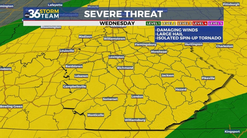
Temperatures this morning are in the 40s and 50s with high temps in the 60s. Winds are already gusting up to 20 mph. These will ramp up even more as we head through the day, gusting up to 30-35 mph later Friday afternoon. A line of showers and storms will move through this afternoon, starting with some scattered sprinkles to the NW. As the cold front moves SE, it will form into a line of storms. We may see a chance for some stronger storms, mainly S of I-64 and W of I-75. This is where we see a Level 2 severe risk. The most likely scenario is a few stronger storms with some hail and gusty winds, and most just see a soaking rain.
However, a few isolated storms may be able to strengthen and become severe. These storms may see some larger hailstones, winds 58+ mph, and a very low threat for spin-up tornadoes. This risk is very small, but not zero. The best way to stay prepared is to know the forecast and have a way to get weather alerts. By dinner time, the NW half of the Bluegrass will be dry, with the front pushing out of the area from 10 pm-12 am tonight.
Saturday
We’ll be clear and mild for Saturday. High temperatures will reach the mid 60s and winds will be light out of the south. Skies will be partly cloudy through the day. If you’re heading out to Kroger Field for UK vs Florida, bring some layers! Kickoff isn’t until 7:30 pm, so the sun will have set already and temperatures will be dropping to the 50s.
Sunday – Monday
Late Saturday night into early Sunday morning, another cold front will be moving through the area. This front may bring a few isolated showers sunday morning. It will drop temperatures during the day to the mid 40s. Sunday afternoon and evening will see mostly cloudy skies with a bit of drizzle possible. Some of this drizzle may transition into some flurries. This is most likely towards the far south and east, mainly closer to the mountains. But it is still possible that we get a few flakes here in the Bluegrass. Ground temperatures will be too high for any kind of accumulations.
Temperatures on Monday start off in the mid 20s. You’ll want to bundle up because afternoon tempratures struggle t make it out of the 30s. A few flurries may be squeezed out of afternoon cloud cover. No travel impacts will occur with any possible snowfall.


