We are kicking off a very active pattern
Meteorologist Jordan Smith has your Saturday evening ABC 36 Storm Team forecast
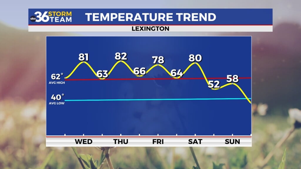
LEXINGTON, Ky (ABC36 NEWS NOW): Good Saturday evening, it has been a warm, muggy, and occasionally stormy day across Kentucky. Unfortunately, more of the same is on the way for the next week as we have entered a VERY active pattern across our part of the country. Sunday should start mainly dry, but thunderstorms will pop up during the afternoon with highs near 80.
Thunderstorms increase in coverage late tomorrow and become widespread into the first half of Monday. Heavy rain is likely and we need to watch the local high water threat.
Thunderstorms will become much more scattered into the afternoon but locally heavy downpours will still be likely. The good news is that no severe weather is expected on Monday as they should just be your general thunderstorms.
That changes up beginning on Tuesday as we have the chance for strong to severe storms, especially across the northern and western part of the state.
The threat then expands east and includes most of Kentucky on Wednesday.
We are likely to see another risk of strong to severe storms on Thursday as well, the SPC just hasn’t put a risk out yet because its still several days away.
On top of the multiple severe weather chances in the week ahead, we will also likely be dealing with some flash flooding issues on multiple days with these repeat rounds of thunderstorms. Please stay up to date on-air and online with the ABC 36 Storm Team through this active stretch of weather. #kywx


