Warm start to Monday ahead of strong-to-severe storm risk
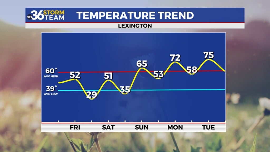
Temperatures will climb into the 70s ahead of storms firing up during the afternoon
LEXINGTON, Ky. (ABC 36 NEWS NOW) – It’s a warm and breezy start to the week across central and eastern Kentucky, and those warmer temperatures will help fuel the development of strong-to-severe storms later today, especially for areas north of the Hal Rogers and Mountain Parkways. A Level 2 (Slight) Severe Risk is in place for much of the ABC 36 viewing area, excluding far southern and south-central Kentucky.
Severe Storm Setup
Afternoon highs will climb into the upper 70s and low 80s across much of central and eastern Kentucky. With strong southerly winds pumping in moisture and instability, scattered storms are expected to fire up in the afternoon and continue into the early evening. The most likely time for severe weather will be between 3 PM and 9 PM.
Primary threats:
-
Damaging wind gusts
-
Large hail (some possibly very large in stronger cores)
-
Low-end tornado risk, with the highest tornado potential in far eastern Kentucky into West Virginia
Storms that develop will generally move east-southeast. Activity should weaken later in the evening as the sun sets and instability wanes, with conditions improving across most of central Kentucky before midnight.
Turning Cooler Midweek
Behind this front, a cooler and quieter pattern settles in for midweek. Tuesday and Wednesday will feel more like early March than mid-April, with highs only in the 50s both days and overnight lows dipping into the upper 30s to low 40s. We’ll be watching closely for frost development Tuesday and Wednesday nights, especially in sheltered valleys.
Warm-Up Ahead of Easter Weekend
By Thursday and Friday, temperatures bounce back into the upper 60s to near 80, just in time for the end of the work week. While Thursday looks mostly dry, we could see a few isolated showers or storms late Friday, depending on the position of a stalling frontal boundary.
Looking ahead to Easter weekend, more rounds of rain and possibly a few storms appear likely, though it won’t be a washout. We’ll have more details on timing and impacts as confidence increases.
Stay with the ABC 36 Storm Team for more updates


