Two severe threats on the way
Meteorologist Jordan Smith has a look at your Friday morning forecast!
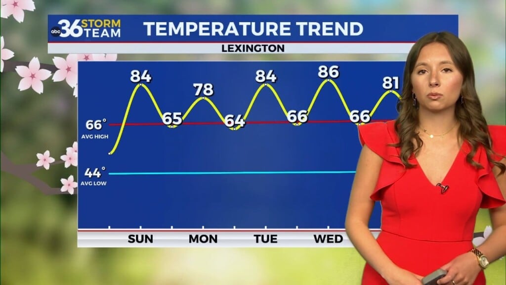
LEXINGTON, Kentucky (WTVQ – ABC 36): Good Friday everyone and welcome to the weekend. After starting the day with some dense fog, sunshine will be taking over this afternoon with highs finally returning back where we should be for this time of year into the upper 80s.

Saturday will feature high temperatures climbing back into the upper 80s to near 90 with more in the way of humidity as well. Scattered showers and thunderstorms will develop during the afternoon and evening.

We have a low end threat for some strong to severe storms, with the best chance being across the central and north. Any storm that possibly turns severe could bring gusty to damaging winds, torrential rain, some hail, and lots of lightning.

Sunday will feature a mix of sun and clouds with high temperatures back near 90. There is a slight chance for a storm, but most of us stay dry.

Monday could bring a better shot at severe weather with the entire area already under the gun for this potential.

Stay with the ABC 36 Storm Team all weekend long on-air and online for updates. #kywx
Back here in the short term:
TODAY:

TONIGHT: