Tranquil weather continues this weekend before showers and storms return next week
High pressure overhead will keep skies mostly clear with temperatures slightly above average this weekend across Central and Eastern Kentucky.
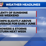
After a cold front moved through late Thursday, both dew points and temperatures dropped today, leaving us behind with near picture-perfect weather to end the work week. Over the weekend, high pressure will continue to be the dominating weather feature, with slowly rising temperatures and plenty of sunshine. By early next week, the chance of showers and thunderstorms will increase as an unsettled pattern returns.

With clear skies and light winds overnight Friday, expect a cool start Saturday morning. With lots of sunshine, high temperatures should have no problem returning to the low 80s by the afternoon. Dew points will continue to remain in check making it a gorgeous day for outdoor activities.

By Sunday, southerly flow will begin to increase and so will temperatures. By the late afternoon and early evening, you may notice a few more clouds and a slight uptick in the humidity, but no rain is expected.

The better chance for showers and thunderstorms will arrive early next week, with several waves of energy passing through Central and Eastern Kentucky. Most of the rain should hold off until late in the day Monday, with periods of wet weather continuing through the middle of the week. There will be plenty of dry time and no one day looks like a washout.