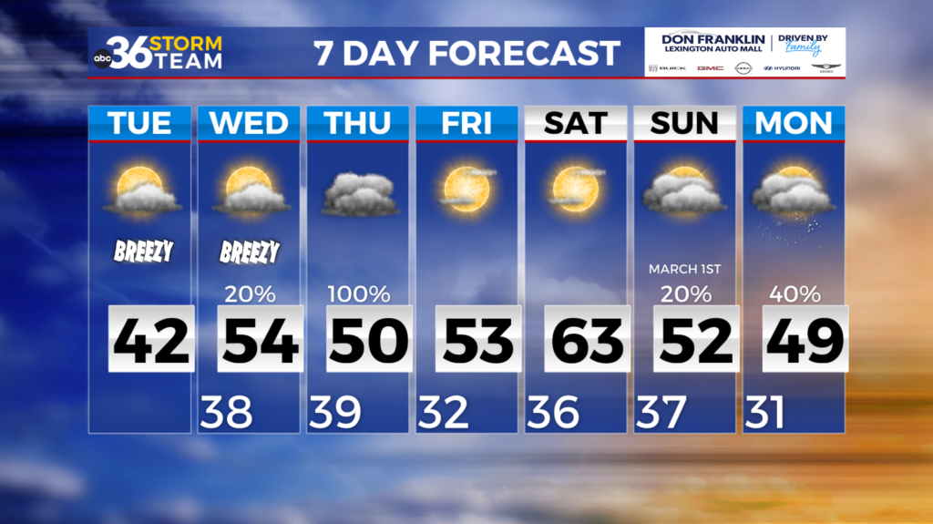
Sunshine and warmer temps return for the weekend
A dreary way to end the work week with overcast skies and highs only peaking in the low to mid 40s, but we will see a big improvement this weekend. Tonight, temps will drop near freezing with a frost advisory is in place for central Kentucky and a freeze warning for northern Kentucky.
Despite the cold start to the day on Saturday, temperatures will climb to the mid and upper 50s with the help of sunny skies. Lows will fall to the mid 30s again Saturday night into Sunday morning, and areas of patchy frost are likely. The gradual warmup continues Sunday with sunny skies and southerly winds, temperatures will peak in the mid 60s.
We will start the work week off Monday morning on the mild side, with temperatures in the mid 50s. Our next chance for showers and storms return Monday, as a cold front sweeps
across the state. Highs will dip to the upper 50s Tuesday and Wednesday behind Monday’s cold front, but we should remain dry until another system brings rain chances Thursday.