Strong-to-severe storm risk across southern Kentucky on Thursday
Large hail and damaging wind gusts are the primary severe weather threats
LEXINGTON, Ky. (ABC 36 NEWS NOW) – After some early morning storms across southern Kentucky, conditions remain quiet for now around Lexington. But we’re watching closely as a round of strong-to-severe thunderstorms is likely to develop this afternoon and early evening, especially south of the I-64 corridor.
The Storm Prediction Center has upgraded much of southern Kentucky to a Level 2 out of 5 (Slight Risk) for severe weather, while central and northern parts of our area—including Lexington—remain under a Level 1 (Marginal Risk). This means the highest threat for severe storms will be from Monticello to Somerset, east through London, Corbin, Hazard, and Harlan, where the atmosphere is more unstable this afternoon.
Severe Weather Threats
-
Large hail (potentially up to 2 inches in diameter)
-
Damaging wind gusts
-
A low-end tornado risk, mainly across south-central and southeastern Kentucky
-
Heavy downpours may also cause brief, localized flooding
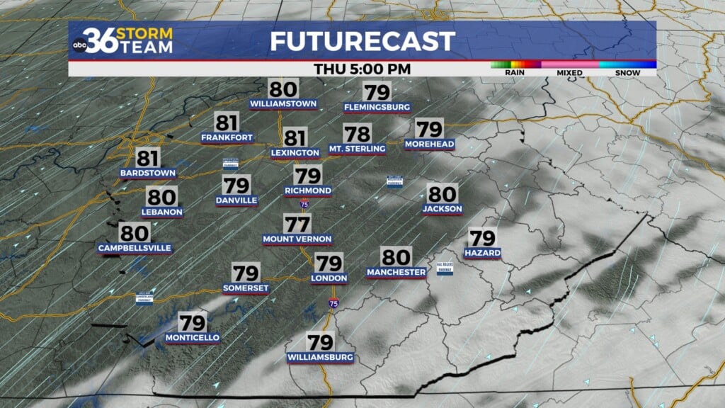
Storms will become more widespread by midday, peaking in intensity between 2 PM and 10 PM, before tapering off late this evening as cooler and drier air filters in behind a cold front.
Turning Cooler Friday and Saturday
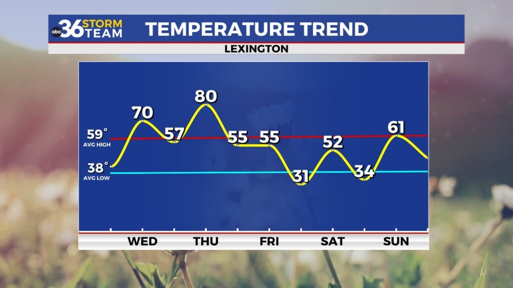
Behind the front, we’ll feel a noticeable cooldown. Highs on Friday will struggle to get out of the mid-to-upper 60s, and skies will slowly begin to clear throughout the day. You’ll really notice the chill Friday night into Saturday morning, with low temperatures dipping into the low 40s, and even upper 30s in sheltered valleys.
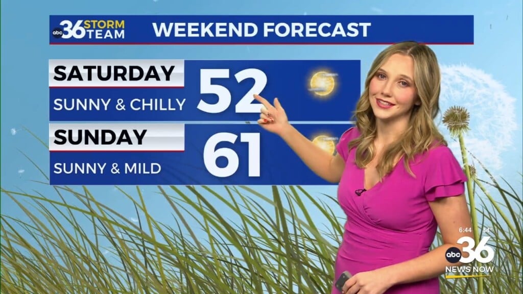
Despite the cool start, the weekend looks pleasant overall. Saturday stays dry and cool, with highs rebounding into the lower 70s under partly sunny skies.
Increasing Clouds on Mother’s Day, Rain Returns Next Week
Clouds will gradually increase on Mother’s Day, but we should stay dry through the day with highs in the mid to upper 70s. By Monday, a slow-moving upper-level low that has been stuck over the lower Mississippi Valley will finally begin drifting our way, bringing back rain and thunderstorm chances.
This dreary pattern could hang around for a few days, with scattered showers and storms possible Monday through Wednesday. We’ll continue to monitor trends as this system evolves.