Strong storms and gusty winds on the way Friday into Saturday
Meteorologist Dillon Gaudet has the latest in your ABC 36 Storm Team forecast
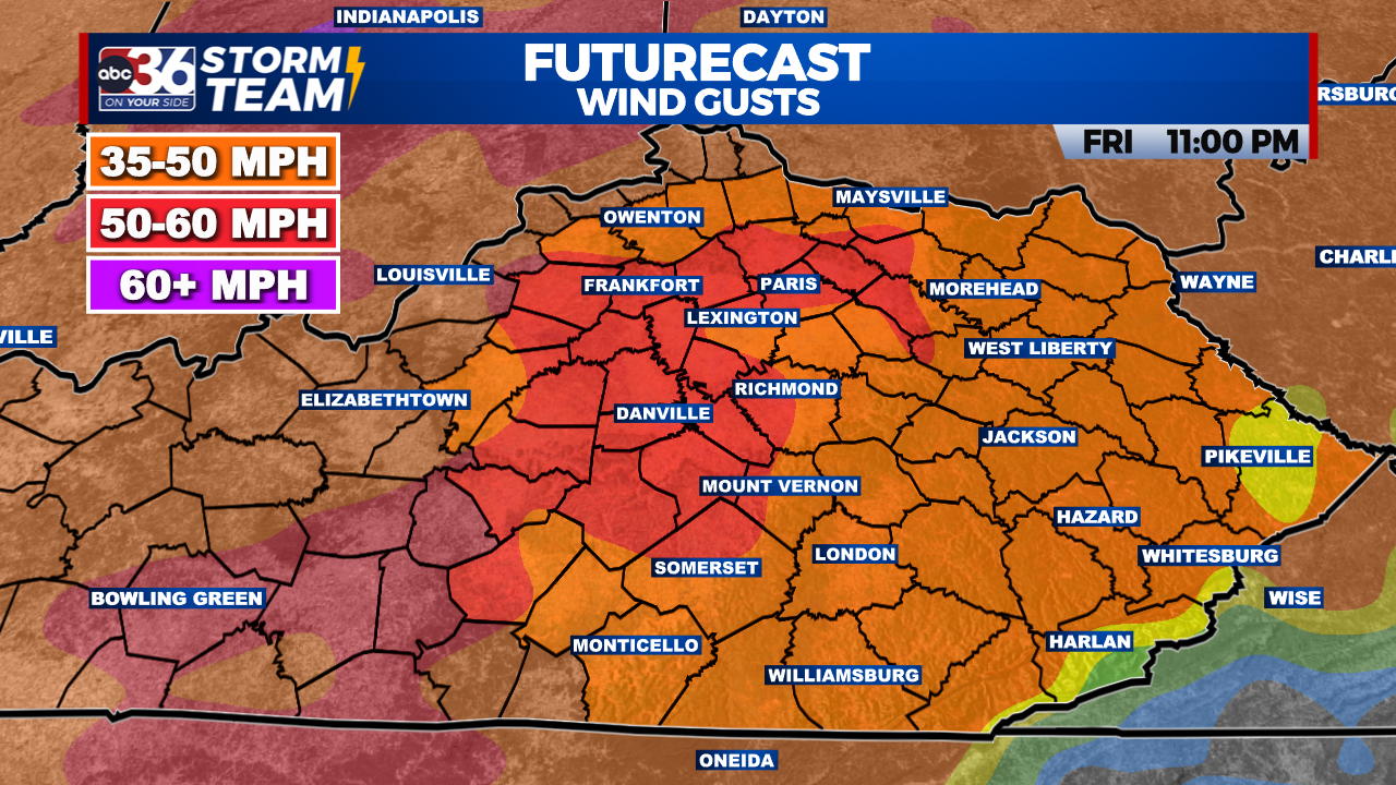
After a beautiful day on Thursday, an active Friday and Saturday are on the way. Off-and-on showers and thunderstorms on Friday will give way to a late evening and overnight severe weather threat. That all leads up to gusty winds that are in the forecast for Saturday. A Wind Advisory goes into effect tonight and lasts through Saturday for all of the viewing area. Wind gusts upwards of 45-55 mph are likely, with the strongest gusts in eastern Kentucky. These wind gusts will be outside of the storms and will likely be strongest after the storms pass.

Here’s a breakdown of the timeline:

Friday Daytime: Showers & storms off and on throughout the day.
Friday Evening-Night: Severe storm threat & gusty winds.
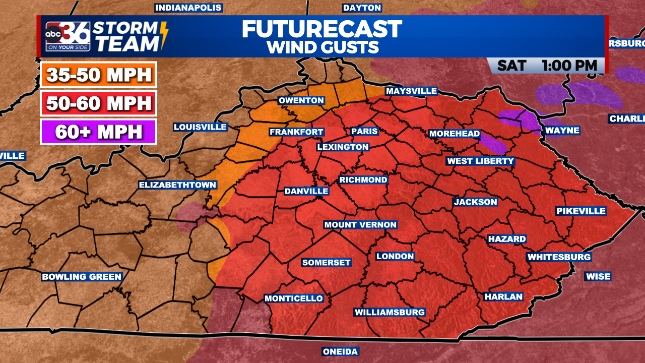
Friday Night-Saturday: Gusty non-thunderstorm wind gusts. 50-55 MPH + gusts will be possible.
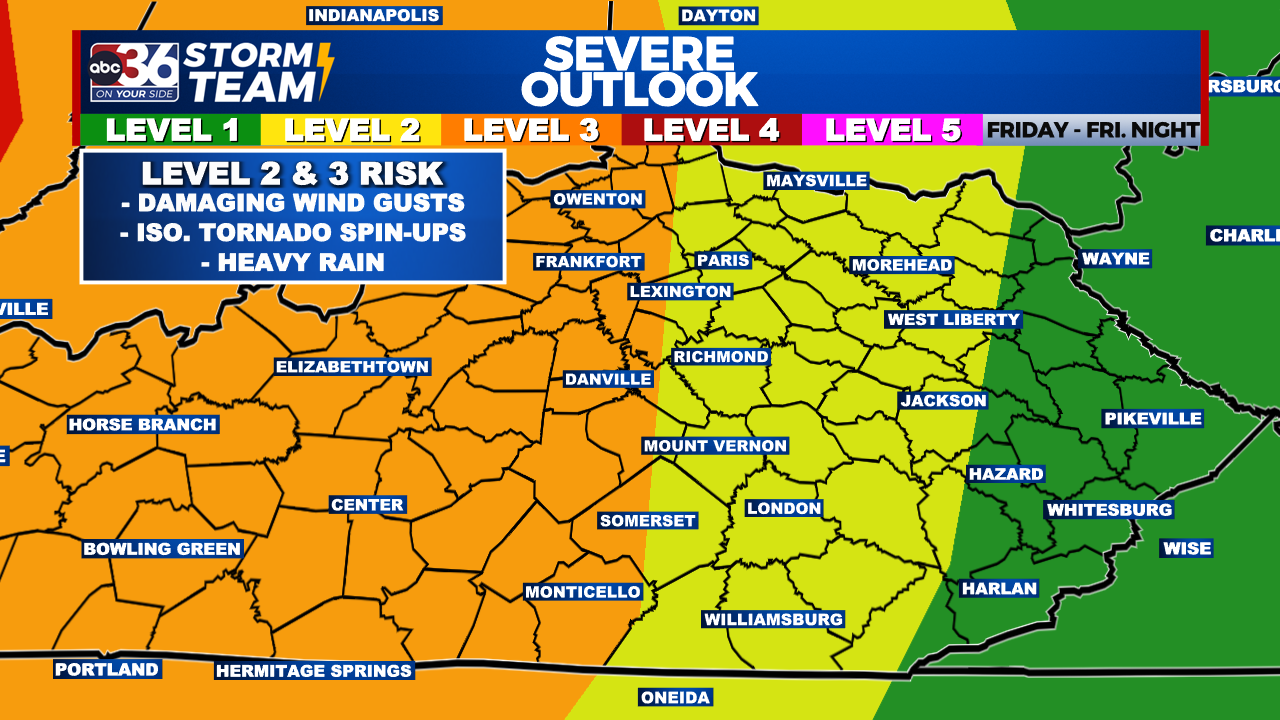


The Friday morning update from the Storm Prediction Center has increased the severe weather threat across the region. Central Kentucky is now under a Level 3 Severe Risk, and the Level 2 Risk has shifted east. Damaging wind gusts continue to be the primary threat, with isolated spin-up tornadoes also possible in central KY.
Make sure you have multiple ways to receive weather alerts. Many of these storms will be occurring after dark, and after many people have fallen asleep. Make sure your method of receiving a warning can wake you up.

Saturday morning as skies clear, strong wind gusts will return. Wind gusts upwards of 50-55+ mph will be possible. Scattered power outages and wind damage will be possible as well.

As the winds die down Saturday evening, the temperatures will be dropping quickly. After temperatures peak near 60, afternoon temperatures will drop into the 40s.
The ABC 36 Storm Team is on your side.
ABC 36 HOUR FORECAST
FRIDAY: Off and on showers and storms. Highs in the mid-60s.
FRIDAY NIGHT: Strong-to-severe storm threat and gusty winds. Temps in the mid-50s.
SATURDAY: Strong and gusty winds. Highs in the upper 50s before dropping into 40s.