Snow likely Friday morning ahead of Sunday’s winter storm
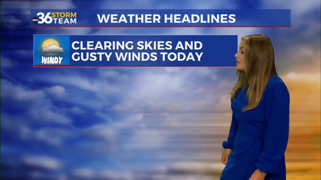
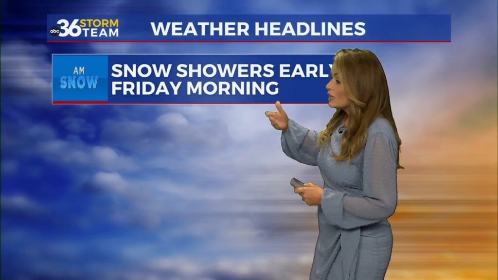
We will likely be waking up to snow showers Friday morning. Not much accumulation is expected, but longer commutes are likely. Temperatures will hover around freezing throughout the day Friday with gradual clearing skies. A high pressure moves in the area Friday making way for a quiet Friday afternoon through Saturday evening.
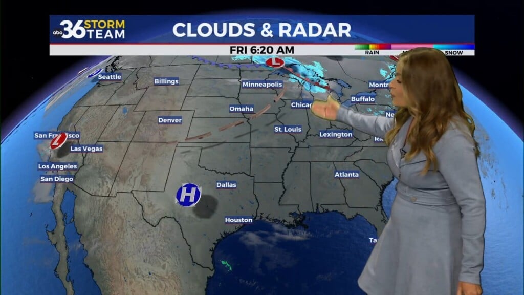
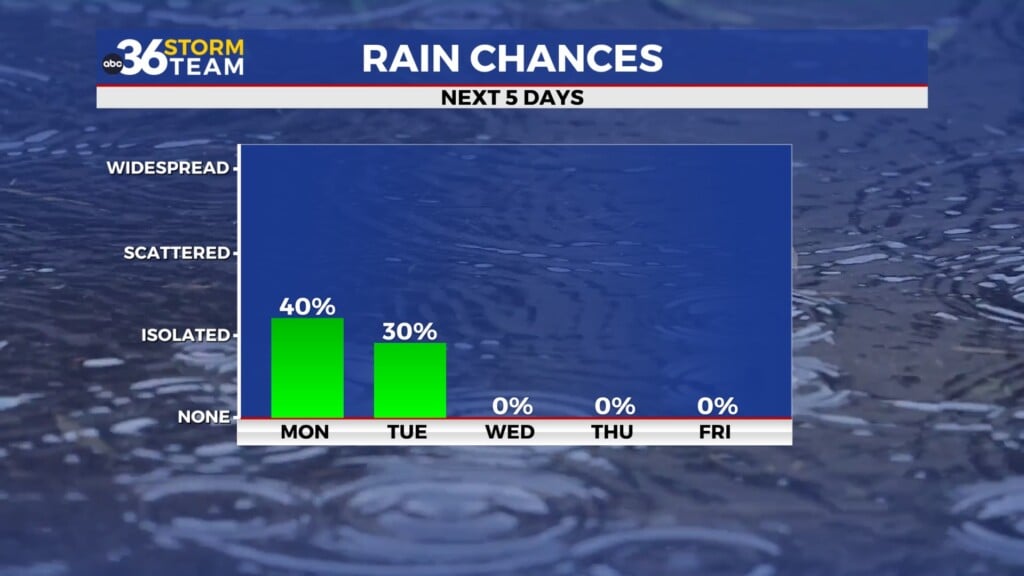
A winter storm is expected to impact central Kentucky Sunday through Monday. The system causing the winter storm is still over the Pacific Ocean and should make landfall Friday afternoon. Data will be collected upon landfall, and we will have a better idea of who can expect snow, ice and rain. The National Weather Service has issued a Winter Storm Watch for many counties in central Kentucky due to snow and ice expected Sunday through Monday.
Behind the winter storm, temperatures take a dive with Tuesday’s highs in the mid 20s and Wednesday and Thursday only peaking in the upper teens. Wind chills will be the real news maker with single digit wind chills expected later next week.