Skies finally clear out on Monday
As skies clear out temperatures will be dropping tonight as a Freeze Warning is out for most of the area
LEXINGTON, Ky. (ABC 36 NEWS NOW) – After days of torrential rain, storms, and significant flooding across central and eastern Kentucky, we’re finally catching a break… at least for now. The sun is breaking through, and Monday is shaping up to be a much quieter weather day across the Commonwealth. But don’t let the sunshine fool you—big swings in temperatures and a few more cold nights are just around the corner.
River Flooding Remains a Concern
While the rain is gone, river flooding continues, especially along the Kentucky River, which crested in Frankfort around 5 AM Monday at 48.27 feet. This is still in Major Flood Stage, and water levels will remain elevated through at least Tuesday evening. If you’ve had to evacuate, continue to monitor guidance from local emergency officials regarding road closures and when it will be safe to return home.
Quick-Hitting System and a Hard Freeze Tonight
Skies will turn mostly sunny across much of the area today, with highs reaching the upper 50s and low 60s thanks to drier air and some sunshine. But a clipper system swinging through later today will bring a quick shot of cold air and a very slim chance for an isolated shower or sprinkle this evening. Don’t expect much rain—most of us stay dry—but a few spots across the Bluegrass may catch a brief sprinkle as the front passes.
Behind that front, cold air rushes in tonight, dropping temps into the mid-to-upper 20s across central and eastern Kentucky. That’s why a Freeze Warning is in effect from late tonight through early Tuesday morning. This is our first hard freeze since the growing season began, so cover any sensitive vegetation or bring plants inside if you can.
A Cold, Breezy Tuesday
Tuesday will feel more like February than early April. Highs will struggle to reach the mid-40s, nearly 20 degrees below average for this time of year. It’ll stay breezy through the day, and with clear skies and dry air in place, another freeze is likely Tuesday night into Wednesday morning, especially across the Bluegrass and eastern Kentucky. Lows will again fall into the mid-to-upper 20s, and another Freeze Watch is in effect for that timeframe.
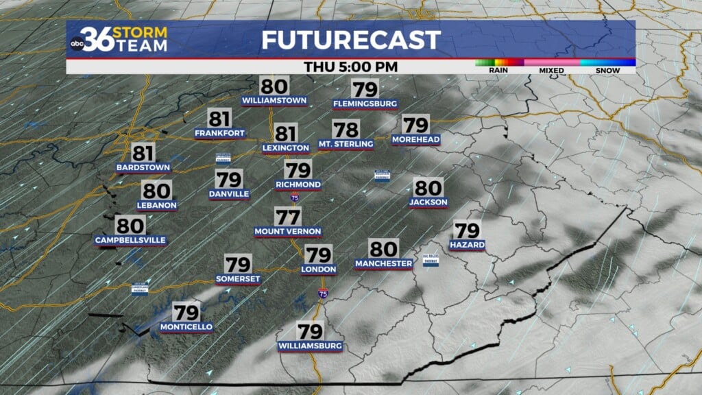
Next Rainmaker Arrives Midweek
A weak low-pressure system will pass through the Ohio Valley midweek, bringing another round of showers Wednesday night through Thursday. This system won’t pack a punch like last week’s storms, but it will keep things unsettled to close out the week. Rain totals look light—generally a quarter to a half inch—with no major impacts expected on rivers.
Thursday also turns breezy, with west winds gusting up to 25–30 mph at times. By Friday, we’ll dry out once again, but cooler air will settle back in, keeping temperatures in the 50s.
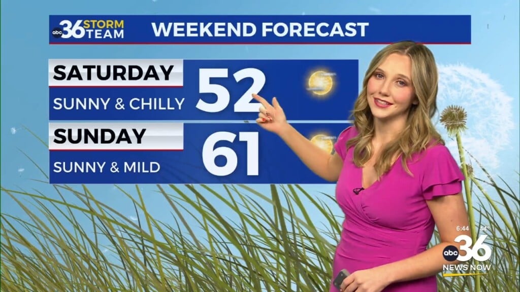
Watching for Frost Again This Weekend
Another round of cold nights is likely Friday and Saturday, especially in the valleys. Patchy frost could develop both nights, so if you’re doing any early spring planting, keep the covers handy.