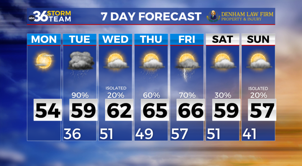
Showers and storms sparking up this evening
This afternoon shaped up to be a pleasant one with a sunshine and highs in the 60s and 70s. The nice weather this afternoon helped with the instability in the atmosphere producing several storms in central and eastern Kentucky. This rain and storms will continue through the overnight and morning hours on Friday as a low pressure moves into the southeast. There is a severe thunderstorm watch for Russell County until 10pm, and all of central and eastern Kentucky is included in a level 1 (out of 5) risk for severe weather, including hail and strong winds.
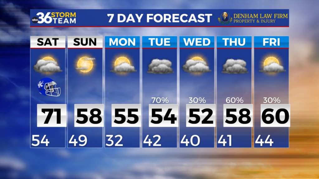
Once the showers kick out of here on Friday, the dry weather will stick around through the weekend. Highs will dip Friday into the low 50s, but we will see a gradual warmup each day through Monday. This weekend is looking great with Saturday peaking in the mid 50s and Sunday in the mid 60s. We will start next work week off on the warmer side with highs Monday in the mid 70s. We will also have our next chance for showers and storms Monday afternoon and evening. Highs sink Tuesday near 60 and remain near 60 through mid-week.