Off and on snow showers on the way Monday
Meteorologist Dillon Gaudet has the latest in your full ABC 36 Storm Team forecast
A Winter Weather Advisory goes into effect today due to snow showers and snow squalls. Be alert for reduced visibility and slick spots during the squalls. Don’t expect accumulating snow outside of the highest ridge tops in eastern Kentucky.
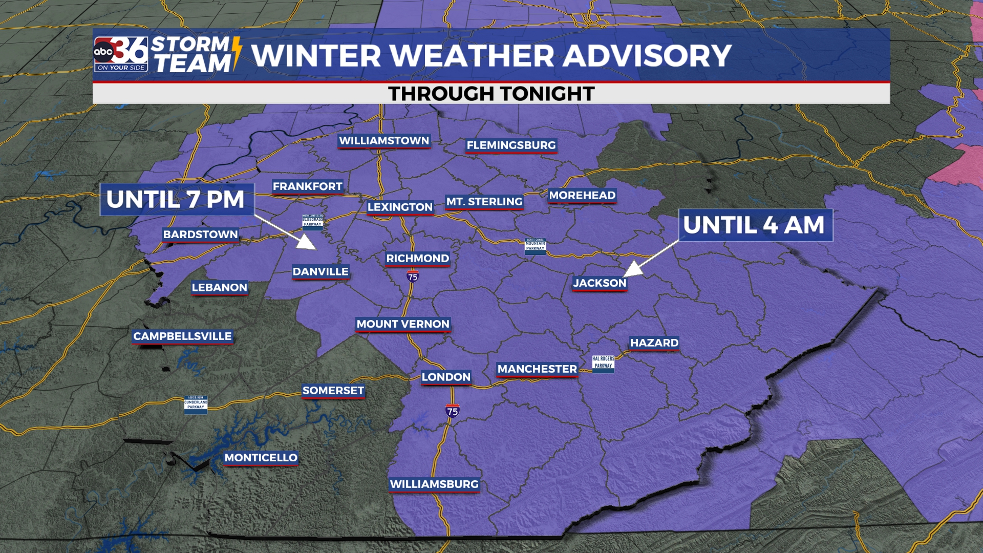
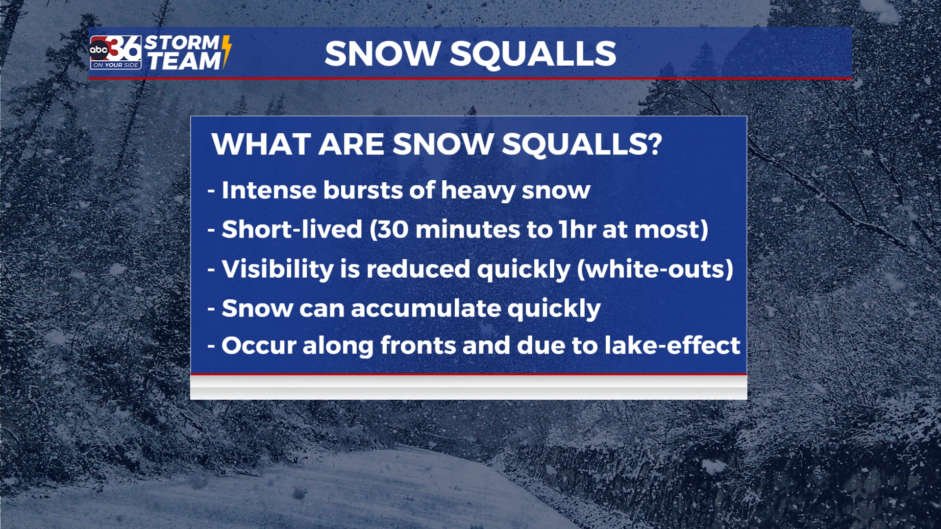
Snow squalls are intense bursts of heavy snow that last anywhere from a few minutes to up to an hour at most. Be careful when driving later today, especially along I-64 and the Mountain Parkway.
As the evening progresses, snow chances will diminish leading to a cold start the day on Tuesday. Air temperatures will be in the upper teens and low 20s, with wind chills dropping down into the single digits in isolated spots. Chilly temperatures will continue throughout the day on Tuesday. Afternoon highs will struggle to reach the mid-30s for most.
Cold air won’t stick around too long. Late week we are expecting a climb in temperatures, by Friday low 50s should return for most. This leads to above average temperatures for the Christmas weekend. Isolated rain chances are in the forecast for the weekend, with a stronger system possible next week following Christmas. Stay with the ABC 36 Storm Team for more updates.
The ABC 36 Storm Team is on your side.
ABC 36 HOUR FORECAST
MONDAY: Off and on afternoon snow showers. Highs in the upper 30s.
MONDAY NIGHT: Few flakes early, cold temperatures late. Lows in the low 20s.
TUESDAY: Mostly sunny and chilly temperatures. Highs in the mid-30s.