More rounds of rain and storms return to Kentucky Tuesday and Wednesday
Heavy downpours and localized flooding concerns increase as an active weather pattern continues
Clouds And Isolated Showers Continue This Afternoon
After starting the day with a few peaks of sunshine, cloud cover has steadily worked its way back into Central and Eastern Kentucky this afternoon along with a few isolated showers.
Temperatures have still managed to warm into the mid to upper 70s for many areas, despite the extra cloud cover. A stalled frontal boundary remains draped across Kentucky, and that boundary will continue to act as the focus for additional scattered showers through the remainder of the day.
Fortunately, rainfall today has remained fairly light for most locations, especially north of the Bluegrass Parkway.
Quiet Tonight Before More Widespread Rain Arrives
As we head through the evening hours, rain chances will begin to taper off for much of the area with overnight lows dropping back into the mid 60s.
However, the overall weather pattern remains very active. An area of low pressure to our south will continue moving closer to the Ohio Valley tonight into Tuesday, bringing deeper moisture back into Kentucky.
Clouds will increase overnight, and by early Tuesday morning we are expected to see another round of scattered showers and storms begin developing across the region.
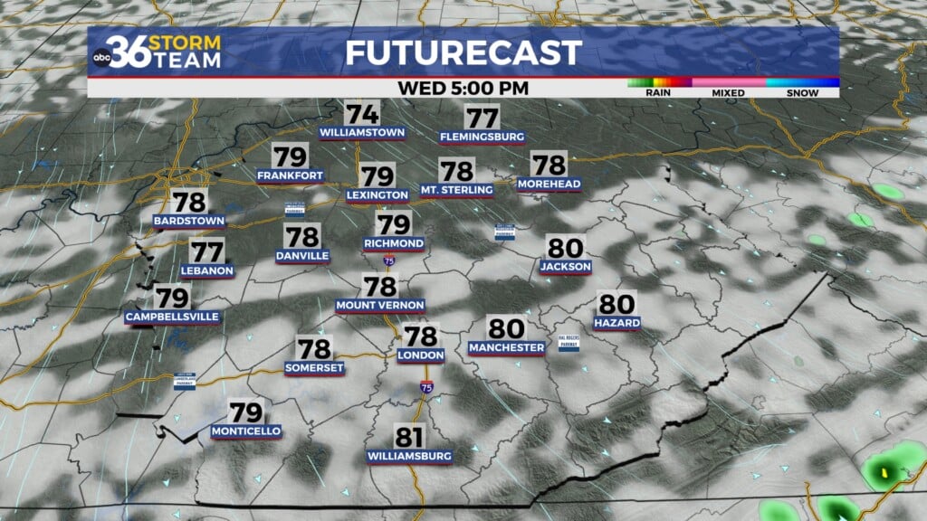
Tuesday And Wednesday Look Wet At Times
Tuesday and Wednesday are shaping up to be unsettled days across the Commonwealth as multiple waves of moisture move northward into the area.
We are not expecting constant rain the entire time, but there will likely be several rounds of showers and thunderstorms moving through both days. Some storms could produce heavy downpours due to the extremely moisture-rich atmosphere in place.
Moisture levels will climb well above normal for late May, which could support localized heavy rainfall and isolated flooding concerns in spots that see repeated rounds of rain.
Rainfall totals could add up quickly in some locations, especially across southern Kentucky where the deepest moisture is expected to set up.
Afternoon highs Tuesday and Wednesday will remain seasonable, generally sitting in the mid to upper 70s with a few lower 80s possible in southern Kentucky.
Drier Weather Finally Arrives Later This Week
By Thursday, we finally begin to dry things out as a cold front pushes much of the deeper moisture south of the area.
While an isolated shower cannot be completely ruled out Thursday, especially south of the Bluegrass Parkway, many areas should see improving conditions with a couple of drier days expected heading into the weekend.
Temperatures through the end of the week will stay comfortable with highs mainly in the mid to upper 70s.
ABC 36 Storm Team 36 Hour Forecast
Monday Night:
Mostly cloudy with scattered showers developing overnight. Mild with lows in the mid 60s.
Tuesday:
Scattered showers and thunderstorms throughout the day with heavy downpours possible at times. Highs in the mid to upper 70s.
Tuesday Night:
Periods of showers and storms continue overnight with locally heavy rainfall possible. Lows in the mid 60s.