Here is your ABC 36 Storm Team Memorial Day forecast!
Meteorologist Jordan Smith has a look at your Sunday evening forecast!
Lexington, Kentucky (WTVQ – ABC 36): Good Sunday everyone, I hope everyone’s Memorial weekend is going great. Today has been about as chilly of the day before Memorial Day you will ever find in Kentucky with most areas not getting out of the 50s for highs with rain and clouds. Portions of central Kentucky reached the low 60s as they had less rain and clouds. Here are todays weather headlines to know where we go from here.

Memorial Day is a huge improvement from today, but your forecast still depends on your location. Central and western Kentucky will see partly sunny to mostly sunny skies by the afternoon with highs deep into the 70s. Southern and eastern Kentucky will see more in the way of clouds and even a isolated shower chance with highs into the low to maybe mid 70s.

By Tuesday everyone, everyone’s thermometer spikes with low to mid 80s and sunshine state wide.

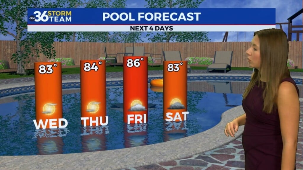
Wednesday – Saturdays forecast is pretty simple with each day bring mid to upper 80s, high humidity, and a scattered thunderstorm going up during the peak heating of the afternoon. Most everyone stays dry, but someone will have to dodge a storm each afternoon. Anyone that sees enough sunshine can hit 90, especially Friday/Saturday. You can see the orange and red colors on the map indicating the hot temperatures.

It is not just going to be hot, but it is going to be steamy with humidity levels that will be way up there. Get ready to sweat!

Back here in the short term:
TONIGHT:

MEMORIAL DAY: