Gloomy Monday ahead of Election Day severe threat
Meteorologist Dillon Gaudet has the latest in your ABC 36 Storm Team forecast
After a quiet Mother’s Day across the region we are tracking a gloomy Monday and strong-to-severe storms on Tuesday for Election Day. A few spotty showers and mostly cloudy skies will be present through much of the day on Monday. There will be a large temperatures discrepancy as well. Northeast Kentucky will struggle to reach the low-70s, while the Lake Cumberland region will climb near 80. Attention then turns to the heavy rain and strong storm threat on Tuesday.

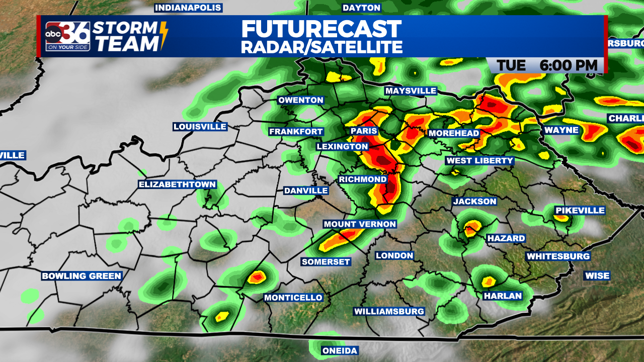
There is a Level 2/5 (Slight) Severe Risk and a Slight Risk for flash flooding on Election Day. For the Level 2 Severe Threat damaging wind gusts and large hail are the primary threats. The tornado threat is low, but not zero. The timeline for the strongest storms will be in the afternoon into the early evening.

Heavy and potentially flooding rain is also a concern for Tuesday. A quick 1-2″ of rain will fall within most of the storms, with 2-3″ possible in the heavier downpours. Low-lying and flood prone areas will be most susceptible.
TIMELINE
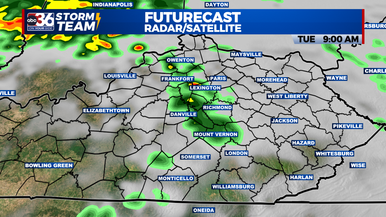
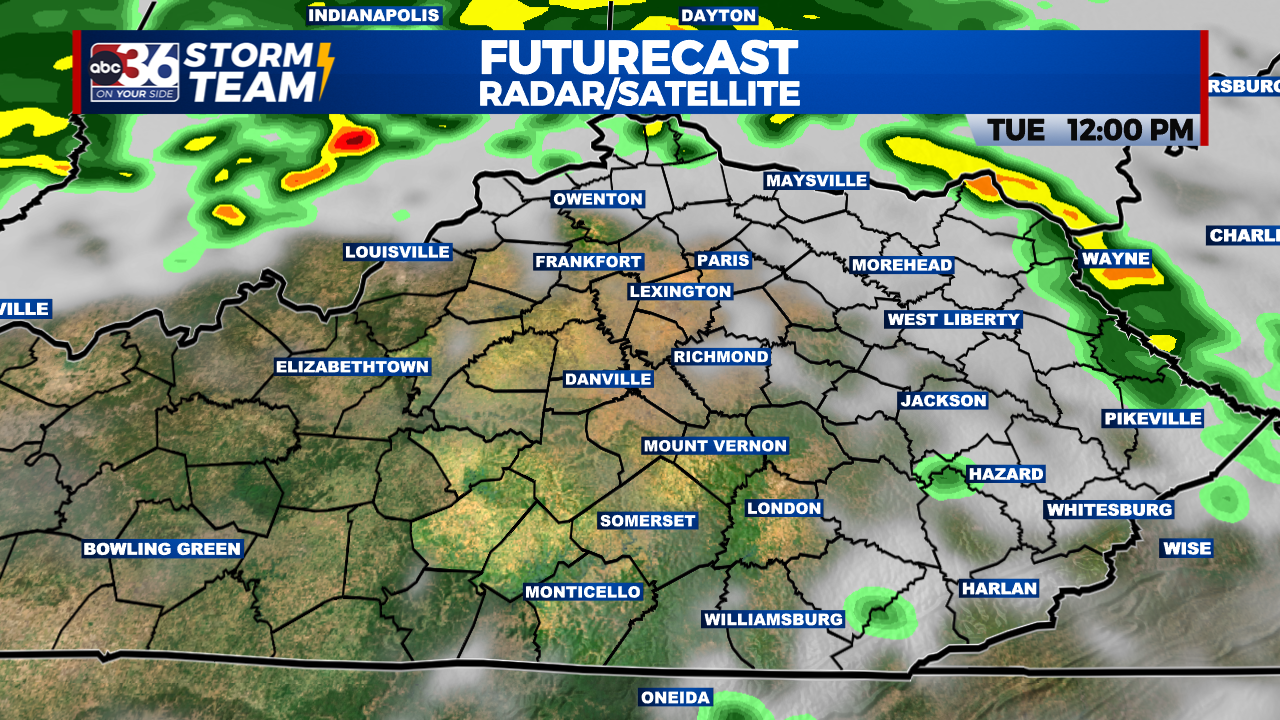
Mid-morning: 1st round of showers mid-morning
Lunchtime: Break in the action, temps climb
Afternoon-early evening : Severe threat, heaviest rain
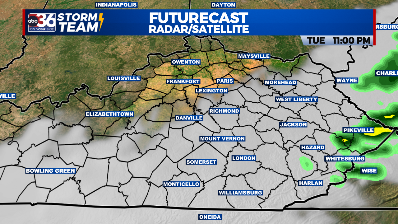
Late evening: Threat moves east
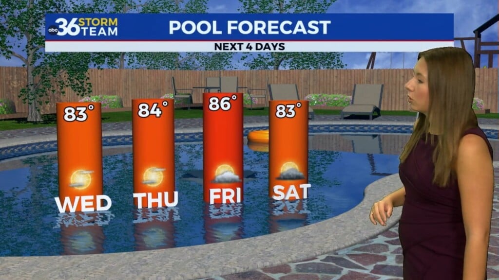
The forecast improves in a big way Wednesday and Thursday. Seasonable temperatures, dry conditions, and sunny skies will be plentiful. Our Dillon Gaudet “Go Day” is Thursday. The next system will be moving through the region during the first half of the weekend. A cold front will pass late Friday night into Saturday with a round rain followed by cooler-air.
https://twitter.com/GaudetWeather/status/1658120877194592259?s=20
The ABC 36 Storm Team is on your side.
ABC 36 HOUR FORECAST
MONDAY: Mostly cloudy skies and a few showers. Highs in the 70s.
MONDAY NIGHT: Mostly cloudy and quiet. Lows in the upper 50s.
TUESDAY: Morning showers, with PM strong-to-severe storms. Highs in the 70s.