Drying out and cooling down to start the work week
Sunday’s cold front brings cooler temperatures
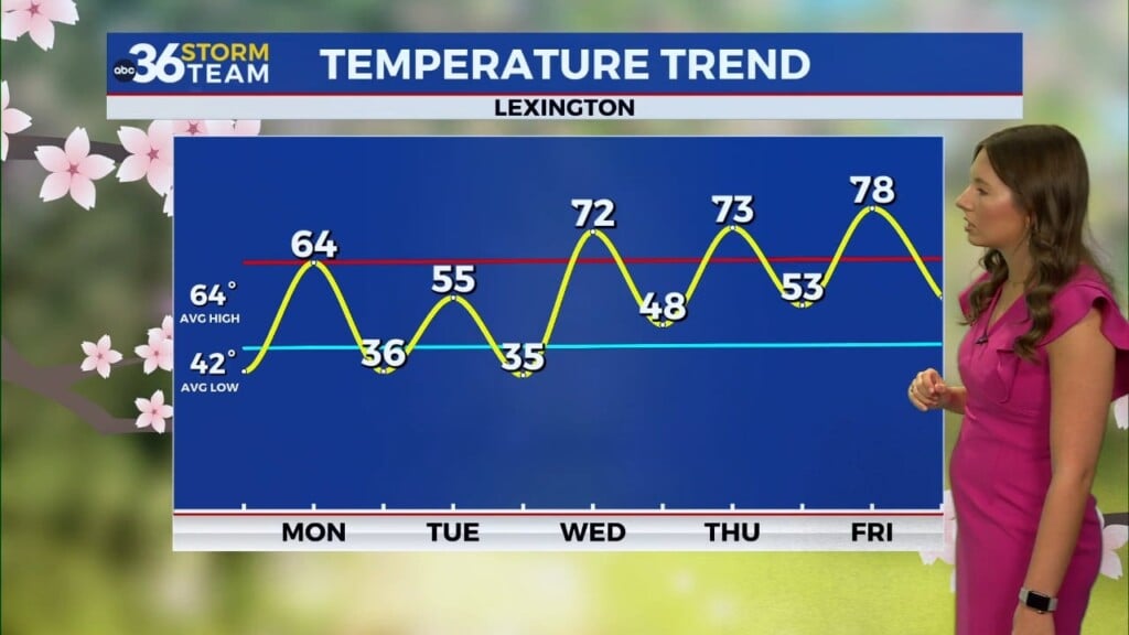
Yesterday we saw quite a bit of rainfall throughout the Bluegrass, with many reaching 0.5-1.0″ of rain. We also saw gusty winds and chilly temperatures. Things have calmed down a bit for our Monday, with clear skies and winds only 10-15 mph out of the SW. Temperatures definitely started chilly though, with many in the upper-30s and lower-40s. By the afternoon, we’ll still have clear skies and lots of sunshine, but temperatures will only top off in the low-mid 60s.
Another overnight cold front is on its way
Monday night will see another cold front moving through, but this one is a lot weaker. It will only bring in some light cloud cover and a small (less than 20%) chance for a few isolated showers. Some may start their morning off with a bit of drizzle, but we’ll be mostly dry through the late morning, and by the afternoon, we’ll only see a few clouds left over. Temperatures on Tuesday will be the warmest for this forecast period, right at average in the upper 60s.
Chilly mornings ahead
Following the second cold front, mid-week will see even cooler temperatures than we started the week with. Afternoon high temperatures are trending below average in the low-60s. We may see some opportunities for widespread frost on Thursday and Friday morning as temperatures will dip into the mid-upper 30s across much of the Bluegrass. Overall, your fall wardrobe will get a lot of use this week.


