Dry air settles into Kentucky as sunshine dominates through the week
Comfortable temperatures and lower humidity stick around before shower chances return this weekend
Sunshine and Lower Humidity Make for a Beautiful Tuesday
It’s been a fantastic start to Tuesday across Central and Eastern Kentucky. Sunshine has been abundant, temperatures have started the day on a mild note, and perhaps most noticeably, the humidity has dropped significantly compared to what we’ve experienced over the past several weeks.
A strong area of high pressure building south from Canada is helping usher much drier air into the Ohio Valley. As a result, dew points and humidity levels have fallen, making it feel much more comfortable outside despite temperatures climbing into the middle 70s this afternoon.
Aside from a few passing clouds early this morning, skies will remain mostly sunny through the rest of the day with highs reaching the mid to upper 70s across much of the region.
Breezy Conditions Continue Through This Afternoon
Along with the sunshine, some breezy northeast winds will develop this afternoon as the strong high pressure system settles into the area.
Wind gusts could occasionally reach 20 to 25 mph, especially during the afternoon hours. While the breeze may be noticeable, it will help keep temperatures comfortable and humidity levels low.
The combination of sunshine, lower humidity, and seasonable temperatures will make for one of the nicest days we’ve seen in quite some time.
Cool and Comfortable Tonight
Clear skies will continue overnight as the dry air mass remains firmly in place.
Temperatures will drop back into the mid to upper 50s by Wednesday morning, with a few traditionally cooler valleys potentially slipping into the lower 50s. The comfortable overnight temperatures will make for another refreshing start to the day.
Dry Weather Dominates the Rest of the Workweek
The weather pattern remains very quiet through the remainder of the week as high pressure continues to dominate the eastern United States.
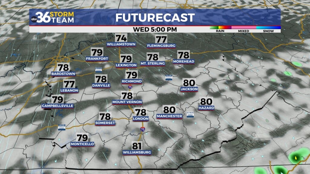
Wednesday, Thursday, and Friday all look very similar, featuring plenty of sunshine, low humidity, and gradually warming temperatures. Afternoon highs will climb from the upper 70s and lower 80s on Wednesday into the middle and upper 80s by Friday.
Even as temperatures warm, humidity levels are expected to remain relatively low, keeping conditions much more comfortable than a typical early June pattern.
Weekend Warm-Up Comes with Returning Rain Chances
The dry streak is expected to continue through most of Saturday before changes arrive later in the weekend.
Forecast models continue to indicate that a low-pressure system will move into the Ohio Valley late Saturday into Sunday. As moisture increases, so will the chances for showers and thunderstorms.
At this point, Saturday daytime appears largely dry with warm temperatures reaching the low to mid 80s. Rain chances are expected to increase Saturday night and continue through Sunday as a cold front approaches and eventually stalls across the region.
The front may linger into early next week, keeping occasional shower and thunderstorm chances in the forecast through Monday.
ABC 36 Storm Team 36-Hour Forecast
Tuesday
Mostly sunny, breezy, and comfortable. Highs in the mid to upper 70s.
Tuesday Night
Clear and cool. Lows in the mid to upper 50s.
Wednesday
Sunny and pleasant with low humidity. Highs in the upper 70s to lower 80s.