Cooling down and drying up to start our Monday morning
Big temperature drop as cold front moves through
A cold front has swept through the Bluegrass region, bringing a noticeable shift in the weather.
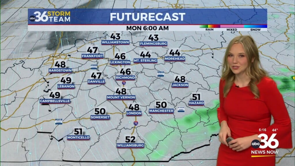
Temperatures have dropped sharply, by as much as 35 to 40 degrees compared to Sunday, with Monday morning temperatures falling into the 40s and 50s. Any lingering rain moved out early, leaving behind cloudy skies through the morning.
Breezy northwest winds will continue, with gusts around 25 mph, making it feel cooler and somewhat blustery.
Clearing skies but a chilly night ahead
Skies will gradually clear through the day as high pressure builds in from the west, allowing for more sunshine during the afternoon. Even with the sun, temperatures will only recover into the 50s.
Clearer skies and lighter winds overnight will allow temperatures to drop into the 30s, with some areas dipping below freezing by early morning.
Quiet and warming through midweek
High pressure will keep conditions dry through the first half of the week.
A steady warming trend will develop, with temperatures climbing each day. By mid to late week, highs will return to the upper 70s and even near 80 degrees.
Next rain chances late week
The next opportunity for showers and thunderstorms arrives late Wednesday into Thursday as a weak system moves into the region.
Another stronger cold front is expected toward the end of the week, bringing another round of rain and storms followed by cooler air heading into the weekend.