Calm weather Friday turns active this weekend
Warming up through Saturday afternoon
Temperatures started chilly Friday morning in the 40s for most, with a few even dropping to the upper-30s. Friday afternoon, we’ll warm to the mid-70s with a light southeastern breeze and a few clouds building throughout the day. Temperatures will be in the 70s and 60s this evening, so maybe bring a light jacket to Friday night football. Saturday morning will have overnight cloud cover, keeping temperatures in the mid-50s. Saturday afternoon will be warm with many reaching the low 80s.
Weekend rain chances
There is a low, isolated (20%) chance of rain Saturday afternoon and evening. Most will stay dry, but bringing rain gear to any outdoor plans isn’t a bad idea. If you’re heading to Keeneland or UK homecoming Saturday, you might want to bring a poncho, though I don’t think it should get much use. Rain chances will increase overnight from Saturday into Sunday morning, as a cold front moves through, bringing a line of showers and thunderstorms.
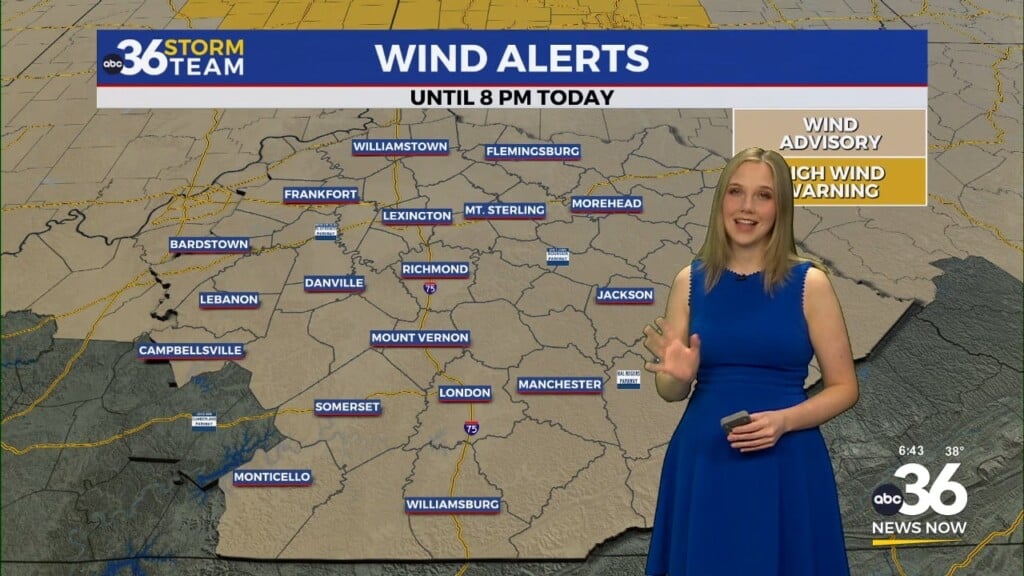
Sunday’s weather impacts
The line of storms moving in overnight into Sunday morning looks to bring a severe threat to western KY. This threat may seep into the Bluegrass if storms remain organized. Right now, it looks more likely that the line will decay before getting into our area. Still, there is a level 1 severe risk for areas west of I-75 for the possibility of wind gusts up to 60 mph. A spin-up tornado threat to our west may bleed into some of our westernmost counties, but that possibility is very low. But it’s not zero, so stay weather aware! After the storms, Sunday will be blustery with wind gusts up to 30-35 mph out of the south and temperatures in the 60s.