Another round of showers Tuesday ahead of a break in the pattern
Meteorologist Dillon Gaudet has the latest in your full ABC 36 Storm Team forecast
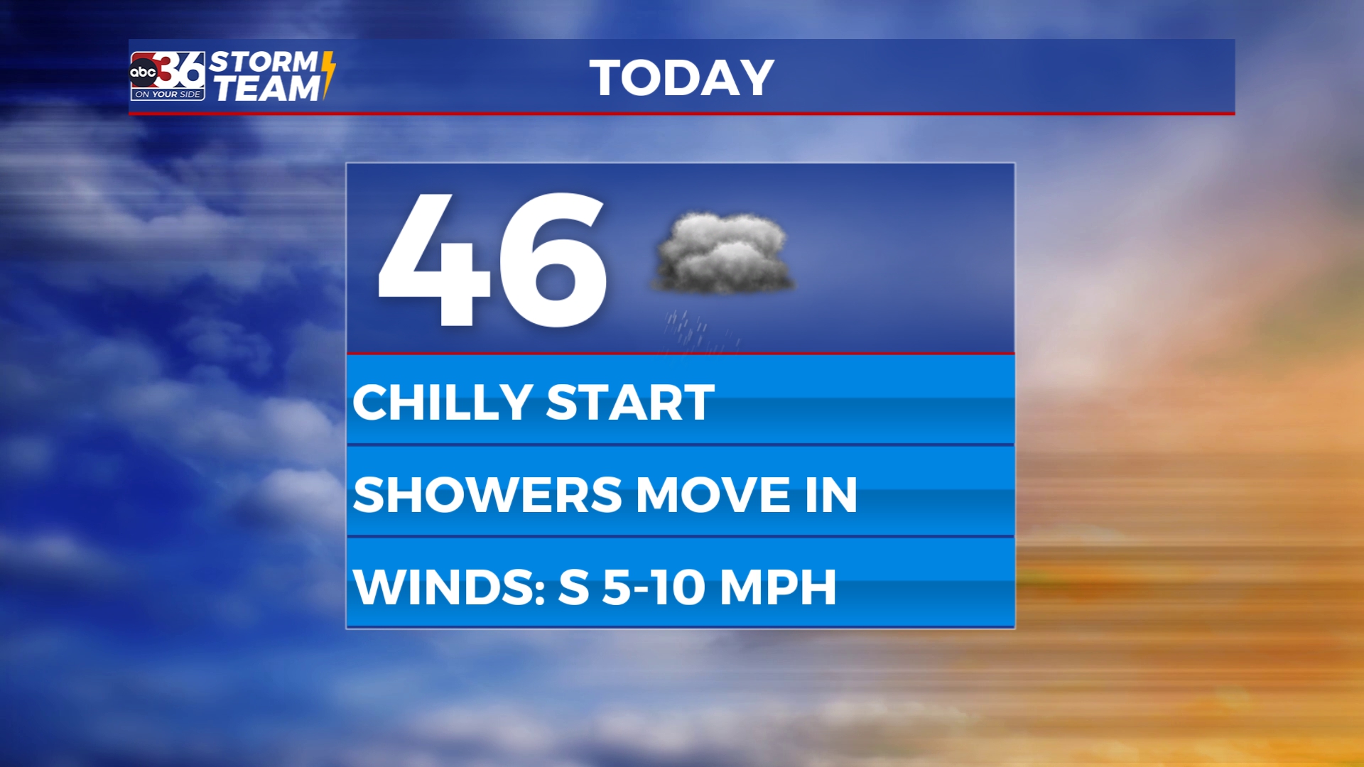
Good morning Kentucky! We are tracking chilly temperatures to start your day with rain expected to move in during the midday and afternoon hours. Temperatures will start to climb during the mid-to-late morning hours ahead of the rain showers. Showers arrive from the northwest, impacting the bluegrass region by lunchtime. Southeast Kentucky won’t see the rain until later in the afternoon, allowing temperatures to climb into the low 50s. Once the rain arrives expect temperatures to drop slightly, leading to chilly rain showers for the afternoon and evening. Southern & southeastern Kentucky will see another wave of rain into the evening hours, while most other areas will just see light showers.
Overnight into Wednesday morning a few flurries will be possible as the system exits. This won’t amount to much of anything but don’t be surprised to see a few flakes flying if you have an early start to Wednesday. Temperatures will remain chilly throughout the day on Wednesday thanks to lingering cloud cover and northwesterly breeze. As skies clear Wednesday night, temperatures will return to the low 30s Thursday morning.

Thursday is where our pattern begins to change. Skies finally clear out and temperatures will begin to climb. Afternoon highs on Thursday will reach the upper 40s and low 50s. Mid-50s will be possible Friday into Saturday as we stay dry. The next chance of rain won’t be until Sunday into Monday. However, this is still a low chance. Models don’t have a good grasp on the exact track of a system that will bring rain to the deep south. A more northerly track will bring us a rain chance, especially in southern Kentucky. A southerly track would keep the rain to our south and we will stay mainly dry.

Stay with the ABC 36 Storm Team for more updates.
ABC 36 HOUR FORECAST
TUESDAY: Mostly cloudy with afternoon and evening showers. Highs in the 40s.
TUESDAY NIGHT: Showers exit with a few flurries possible. Lows in the low-t0-mid 30s.
WEDNESDAY: A few morning flurries with mostly cloudy skies. Highs in the low 40s.