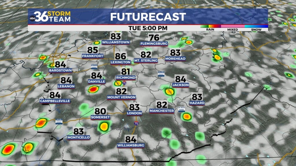
Warming trend continues as quiet weather settles in
Warmer days with limited rain chances
A steady warming trend will take hold as milder air moves into the region.
Another weak system may pass through Thursday afternoon, but it is expected to bring little more than some clouds and perhaps a brief sprinkle. Most areas will remain dry.
Temperatures will climb into the mid 60s to low 70s, marking a noticeable shift toward springlike conditions.
The vernal equinox will occur on Friday morning, marking the official start of spring. Much of the day will stay warm and dry, though there is a chance for pop-up thunderstorms late evening through the overnight.
Spring warmth builds into the weekend
Warmer air continues to build heading into the weekend, with plenty of sunshine expected.
High temperatures will rise into the 70s.
Cooler air returns early next week
A cold front is expected to move through late Sunday into early Monday, bringing a slight chance of light showers.
At this point, the system does not appear particularly strong, and most of the rain may occur east of I-75. A brief rumble of thunder or small hail cannot be completely ruled out, but overall impacts look limited.
Behind the front, temperatures will cool back down into the 50s and 60s to start the new week.