A foggy start to Presidents Day, with spring-like temps ahead
Dense fog and slick spots this morning
Dense fog is impacting much of the Bluegrass region this morning, with visibility dropping to a quarter mile or less in spots.
A Dense Fog Advisory is in effect until 10 AM, and travel may be slow through the morning commute. In addition to low visibility, slick spots may form on bridges and overpasses where temperatures briefly dip below freezing. Patchy black ice could develop on elevated surfaces before temperatures rise.
Fog will be slow to lift after sunrise, but gradual improvement is expected by late morning to midday.
Mild and quiet weather today and tonight
Once the fog clears, conditions turn mild and dry for the rest of the day.
Despite a slower warm-up, temperatures climb into the upper 50s and low 60s across the Bluegrass.
Skies remain mostly dry through tonight, with lows falling into the upper 30s and low 40s. While some patchy fog could redevelop late tonight, widespread dense fog is not expected.
Warming trend continues midweek
A warming trend takes hold Tuesday and Wednesday as upper-level ridging builds over the region. Highs rise into the mid-60s to near 70 degrees, well above normal for mid-February.
Breezy conditions develop Tuesday night into Wednesday as a strong system passes well north of Kentucky.
A brief, light shower cannot be ruled out for Wednesday morning, but impacts look minimal.
Active pattern returns late week with storm chances
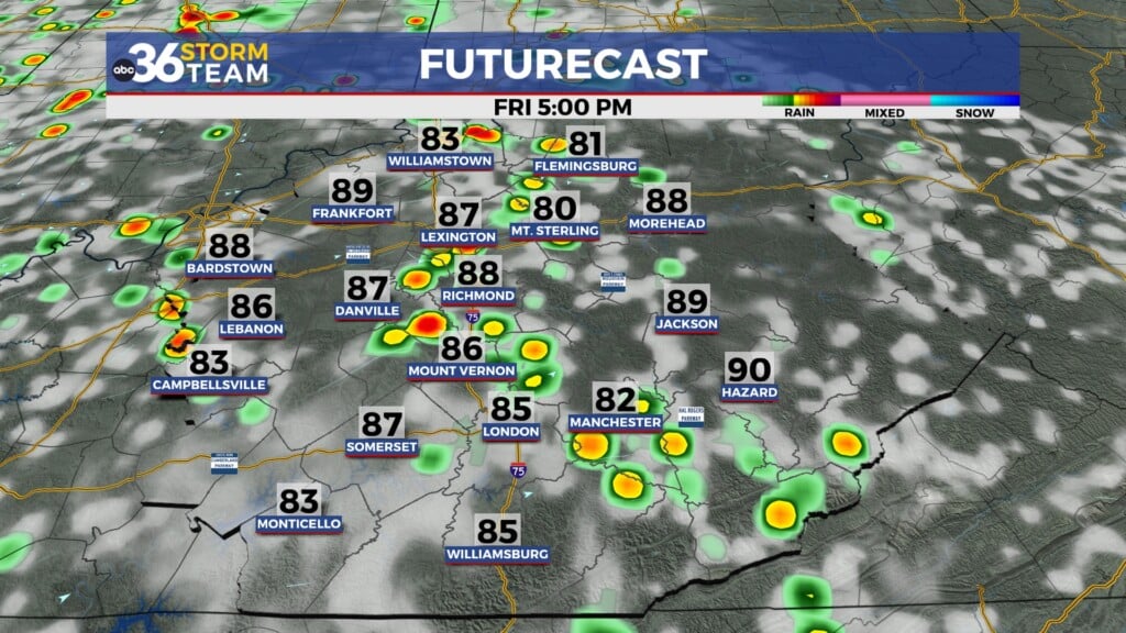
Thursday looks to be the warmest day of the week, with temperatures potentially reaching the low to mid 70s in parts of the Bluegrass and flirting with record highs.
As a frontal boundary approaches, scattered showers and thunderstorms become more likely Thursday night into Friday.
Some storms could become strong, with gusty winds and heavy downpours possible, though uncertainty remains regarding instability and overall storm intensity. A lot could change before we get to the end of the week.
Another disturbance may bring additional rain chances into Saturday. Confidence is lower this far out, but unsettled weather may linger into the weekend before cooler air returns by Sunday.