A mix of sun, clouds, and spotty shower chances before a mild weekend
A Mild Friday Leads Into a Warm, Breezy Weekend Before Changes Arrive Early Next Week
A Chilly, Clear Start to Friday
We kicked off this Friday morning on a chilly and quiet note, with overnight lows dipping into the upper 30s and low 40s across much of the region. Thanks to calm winds and clear skies, some rural spots even briefly slipped into the low 30s before sunrise. As daylight arrived, sunshine returned in full force, helping temperatures recover quickly.
Clouds Increase This Afternoon With a Few Light Showers Possible
Sunshine dominates early today, but clouds will gradually work back in around lunchtime as a southwesterly breeze picks up. This stronger southwest flow is tied to high pressure shifting east and warmer, slightly more humid air moving into the region.
Despite the clouds, the day stays mild—highs reach the low to mid-60s across the area. A few isolated showers may pop up later this afternoon and into the early evening, though many spots will stay dry.
Mild Tonight With Clouds Increasing Late
Temperatures won’t fall much tonight thanks to warm southwest winds continuing. Lows settle into the low to mid-50s, which is well above normal for mid-November. Clouds will continue to thicken late tonight into Saturday morning ahead of a weak cold front still positioned to our northwest.
A Fantastic Saturday Ahead
Saturday is shaping up to be the warmest day of the week. Even with some additional cloud cover, strong southwest flow will push highs into the low to mid-70s—a solid 10–15 degrees above average.
It will be a breezy day at times, but overall pleasant and partly sunny.
Saturday Night: A Few Light Showers East of I-65
A cold front sweeps through the area late Saturday night. The front won’t have much moisture to work with, but a few brief, light showers are possible—mainly east of I-65, and most likely east of I-75. Many locations west of I-65 may stay completely dry.
Cooler but Pleasant Sunday
Behind the front, cooler northwest air moves in for Sunday, but the day still looks nice. Morning clouds and a few isolated leftover showers will give way to sunshine.
Highs return to the upper 50s to low 60s, which is seasonable for this time of year.
Monday Turns Cooler; Next Rainmaker Arrives Late Monday Night
Monday starts off chilly with morning lows in the 30s. The day remains dry with highs in the mid-50s to low 60s, but changes arrive by Monday night.
A developing system to our west will pull a warm front toward the Ohio Valley, bringing rain showers back into the region late Monday night into Tuesday. There may even be a small chance for thunder across southern Kentucky.
More Unsettled Weather Midweek
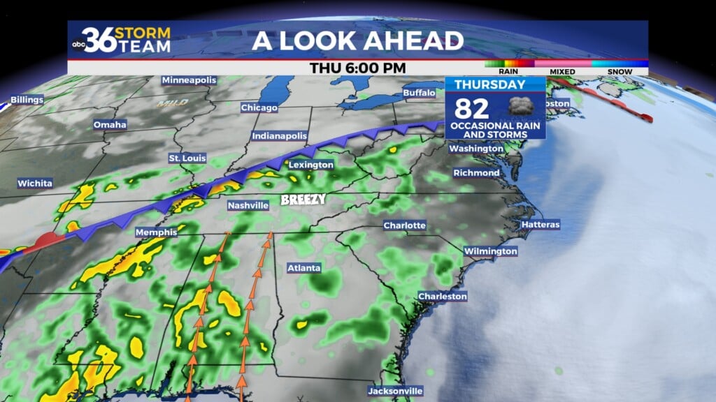
Shower chances linger into Tuesday and Wednesday, though amounts and coverage may vary. Models diverge midweek, but there are signs of another stronger system late next week, which could bring another round of showers or storms.
ABC 36 Storm Team 36-hour Forecast
Friday: Mostly sunny early, becoming partly cloudy later few isolated showers possible. Highs in the low to mid 70s. Southwest winds 10–15 mph.
Friday Night: Partly cloudy skies, staying mild with lows in the low 50s. A wind shift to northwest late, but still mostly dry.
Saturday: Partly to mostly sunny, breezy southwest winds 15–20 mph. Highs in the low to mid 70s again, with a very small chance of a light shower late in the day east of I-65.