Tuesday sees cold temperatures ahead of a slow warm-up
Temperatures on Tuesday morning are in the 20s, feeling like the teens. We’ll continue to see gusty winds and wind chill temperatures around 10 degrees below actual air temperatures. This means that by this afternoon, when we see high temperatures in the 40s, we’ll feel closer to the 30s. Clouds will build through the morning, and we’ll be partly cloudy for the afternoon. Snow will melt once air temperatures warm to above freezing.
Wednesday, temperatures will warm to the 50s by the afternoon, but we’re still windy. Winds calm on Thursday, and we stay in the mid-50s with a few clouds. By Friday, we will likely be back in the 60s.
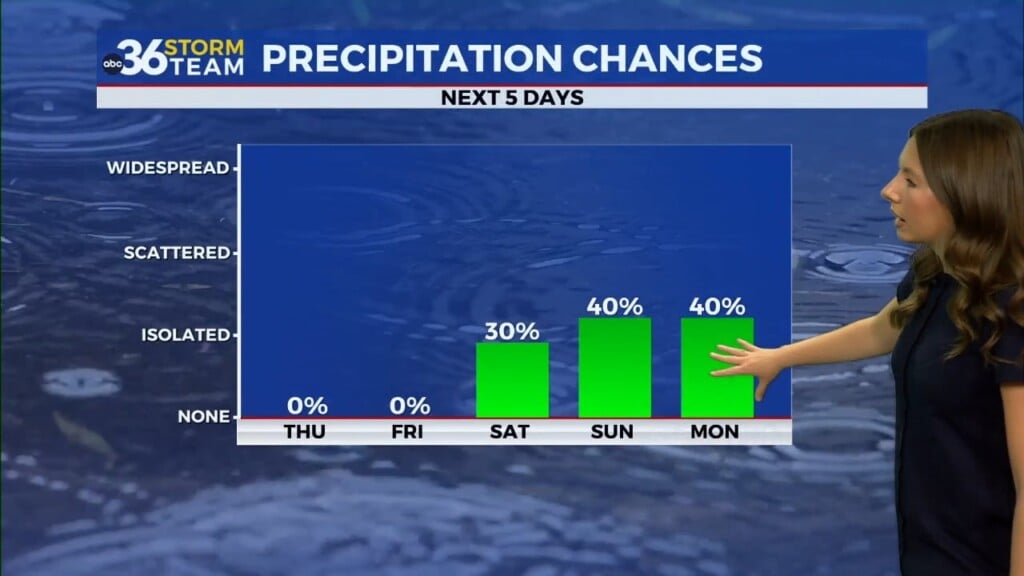
This weekend actually looks warm, with temperatures Saturday in the upper 60s to near 70s. Our next unsettled weather pattern looks to return by early next week, possibly Sunday and/or Monday. This will be our next best chance for rainfall.


