Two more days of the high heat and humidity
Hot and very humid conditions expected Tuesday and Wednesday
LEXINGTON, Ky. (ABC 36 NEWS NOW) – We’re holding steady in this intense stretch of summer heat as we move through your Tuesday, with the worst of the heat still to come. A Heat Advisory remains in effect through Wednesday across the area, as this two-day window is expected to feature the highest temperatures and most intense humidity of the entire stretch.
Expect highs in the mid-90s again today, but what you’ll feel is much more intense. With dew points sitting well into the 70s, heat index values will easily climb to 105°+ in many spots this afternoon. That “air you can wear” feeling is going nowhere—at least not just yet.
While most stay dry today, a few pop-up thunderstorms are possible during the afternoon and early evening hours. These will be typical summer pulse storms—brief, drenching, and highly localized. Most of us won’t see one, but those who do may get some momentary relief from the heat, along with gusty winds and lightning.
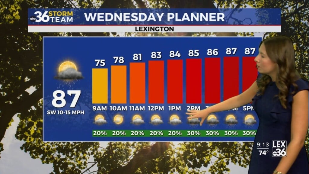
Looking ahead to Wednesday, expect more of the same—another scorcher with mid-90s for highs and dangerous heat index values yet again pushing into the triple digits. Scattered storms will become a bit more likely late in the day as a cold front approaches from the northwest.
That front will bring with it our best chance of widespread showers and thunderstorms on Thursday. Some of the storms may be on the strong side, and locally heavy rainfall is possible. This frontal boundary will also serve as the transition to a much more comfortable pattern.
By Friday and into the weekend, the difference will be night and day. We’ll see lower humidity, cooler highs in the lower 80s, and morning lows dipping into the 50s in the coolest valleys by Saturday morning. A crisp, refreshing feel is on the way—just hang on a little longer!