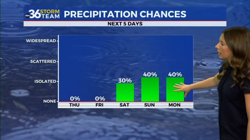
Drier forecast through the rest of the week
Afternoon highs on Wednesday will climb into the mid-80s with lower humidity
LEXINGTON, Ky. (ABC 36 NEWS NOW) – After days of daily rain chances and high humidity, a much-needed break arrives across central and eastern Kentucky. If you’ve been waiting for that perfect summer day to get outside, today is your moment.
We’re starting off your Wednesday with valley fog, especially in our more sheltered areas like the eastern Kentucky hollers and along riverbeds. That fog will burn off by mid-morning, revealing plenty of sunshine and a noticeably drier feel to the air. Afternoon highs will climb into the mid-80s, but thanks to lower humidity, it won’t feel nearly as sticky as it has in recent days.
Tonight stays just as pleasant. Clear skies and light winds will allow temperatures to fall back into the low-to-mid 60s, with patchy fog once again likely in the usual valleys.
Turning Up the Heat by the 4th
The comfortable weather continues into Thursday, although we do gradually start to turn up the summer heat. Highs climb a little higher — into the upper 80s — and there’s just a slight chance of a stray shower, mainly in the afternoon. Most of the region will stay dry.
By Independence Day, we’ll be right back into classic July weather. Expect mostly sunny skies, highs reaching the upper 80s to low 90s, and slowly increasing humidity. While it will feel hot, it’ll still be manageable compared to last week’s tropical conditions. If you’ve got outdoor plans — from barbecues to fireworks — the weather will be cooperating across the board.
Heat and Humidity Make a Comeback
This weekend, summer cranks back up. High pressure shifts east, allowing southerly winds to draw in more moisture and warmth. By Saturday, we’re into the low-to-mid 90s and heat indices could reach the upper 90s in some spots.
Rain chances return late Sunday as a weak front approaches from the north. From there, we could see a stretch of daily pop-up showers and storms early next week — typical July fare driven by heat, humidity, and daytime instability.


