Heat wave continues as rain and storm chances start to increase
Hot and very humid conditions continue Wednesday with a few pop-up storms
LEXINGTON, Ky. (ABC 36 NEWS NOW) – The stretch of hot and humid weather continues across Central and Eastern Kentucky. While we’re not in record-breaking territory, it’s been an extended run of oppressive heat, and today will be no different.
A Heat Advisory remains in effect for much of the region through this evening as temperatures climb once again into the low-to-mid 90s, and heat index values push into the 100 to 105° range. That combination of heat and humidity is enough to make outdoor activities uncomfortable and potentially dangerous if you’re not taking proper precautions.
Try to limit prolonged time outdoors, especially during the peak heat of the afternoon. Stay hydrated, take breaks in the shade or A/C when possible, and don’t forget to check on vulnerable neighbors or pets.
As for rain chances today, a few isolated pop-up showers or storms are possible, mainly north and east of Lexington. The coverage will be slightly higher than what we saw on Tuesday, but still not enough to count on widespread relief. Any storms that do develop could bring a brief downpour, gusty winds, and lightning—so keep an eye on the radar if you’re outside this afternoon.
LOOKING AHEAD: STORM CHANCES AND A LITTLE RELIEF
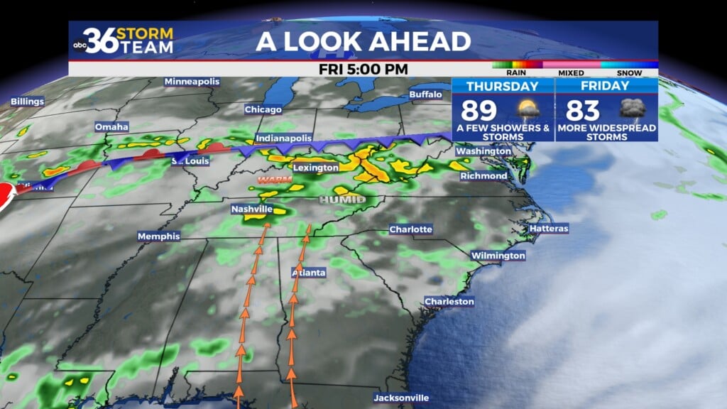
As we move toward the latter part of the week, we’ll begin to see a slight breakdown in the stubborn ridge that’s been parked overhead. That will allow for scattered showers and storms to become more common by Thursday and Friday, especially during the afternoon and evening hours. With the uptick in rain chances comes a modest drop in temperatures, though it will still feel steamy with high humidity.
The weekend brings a better chance of scattered storms, but it does not look like a washout. Expect off-and-on showers or storms around outdoor events or travel plans, but plenty of dry breaks in between.
Long-range trends suggest we may finally catch a break early next week. A cold front may sweep through, bringing with it slightly cooler temperatures in the 80s, and less oppressive humidity—something many will welcome after nearly a week of intense heat.
Stay weather-aware and take care in the heat. We’ll continue to track storm chances closely and keep you updated throughout the week on ABC 36.