Dreary weather pattern continues on Monday
Afternoon highs will struggle to hit the upper 50s with off an on rain showers
LEXINGTON, Ky. (ABC 36 NEWS NOW) – It’s a gloomy start to the new workweek across central and eastern Kentucky, as a stubborn upper-level low remains nearly stationary just to our northwest. This system has been spinning over the region for a few days now, and it continues to wrap showers and even a few rumbles of thunder into our area in a counter-clockwise fashion.
Expect rounds of off-and-on showers throughout your Monday, especially into the afternoon. While not everyone will see constant rain, don’t be surprised if you get caught in a chilly drizzle or quick downpour. Highs this afternoon will struggle to make much progress — we’re only expecting the upper 50s for most of central and eastern Kentucky, with a few 60s possible if clouds briefly break in southern parts of the region.
By Monday night, the system finally starts to lift to the northeast, heading into Ohio. That movement opens the door for gradual improvements. Lingering low clouds and a few stray showers will stick around overnight, but we’ll also start to see signs of clearing in spots, especially west of I-75. Lows overnight will dip into the low to mid 40s.
We’ll see a brief lull in rain chances Tuesday as a weak ridge builds in behind the departing low. Temperatures also bounce back a bit, with highs in the 60s under a mix of clouds and sun.
Wednesday starts off pleasant, with sunshine in the morning and milder temperatures climbing into the low 70s. However, a new disturbance approaching from the west will bring increasing clouds late in the day, and a few showers may sneak in by Wednesday night, especially across southern Kentucky.
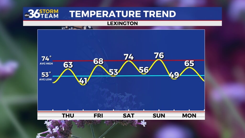
Scattered showers will be possible again on Thursday, but widespread heavy rain is not expected at this time. The good news? A drier pattern appears to be setting up just in time for the weekend. As we head into Friday and beyond, sunshine should return, and temperatures are expected to gradually warm back into the 70s, even reaching the upper 70s by Sunday.


