Few stronger storms possible Wednesday as unsettled pattern continues
Isolated strong-to-severe storms will be possible Wednesday afternoon and evening
LEXINGTON, Ky. (ABC 36 NEWS NOW) – After Tuesday’s active weather, we’re starting off your Wednesday on a quieter note across central and eastern Kentucky. Some fog developed overnight behind the storms, but that’s expected to burn off quickly this morning. As skies turn partly cloudy through midday, attention turns to the potential for another round of thunderstorms later today — though this round won’t be as widespread or as intense as what we dealt with yesterday.
The Storm Prediction Center has outlined much of our region in a Level 1 out of 5 Marginal Risk for severe storms today. That means isolated strong-to-severe storms are possible, especially during the afternoon and evening. A passing warm front may help some storms briefly reach severe limits, with damaging wind gusts, hail, and even a low-end tornado (quick spin-up) threat on the table — though these will be the exception, not the rule.
Outside of the storms, it’s going to feel like early summer. Temperatures will climb into the upper 70s and low 80s again this afternoon, with muggy dewpoints in the 60s making things feel a bit sticky. Any storms that do develop today should weaken after sunset, with a relative lull expected overnight.
But the break won’t last long…
Looking Ahead: More Storms on Thursday
Thursday brings another uptick in storm chances, and this time the SPC has placed most of Kentucky under a Level 2 out of 5 Slight Risk for severe weather. Expect scattered thunderstorms to pop during the afternoon and evening, particularly as another cold front pushes into the region. These storms may pack a bit more punch, with gusty to damaging winds, locally heavy rainfall, and marginal hail all possible. Make sure you’re staying weather aware through Thursday evening.
Unsettled Pattern Continues Through Kentucky Oaks and Derby weekend
Our active pattern doesn’t end there. As we head into Friday and Kentucky Oaks Day, additional showers and storms are expected — especially during the afternoon and evening. While not an all-day washout, on-and-off rain and rumbles of thunder could impact outdoor plans.
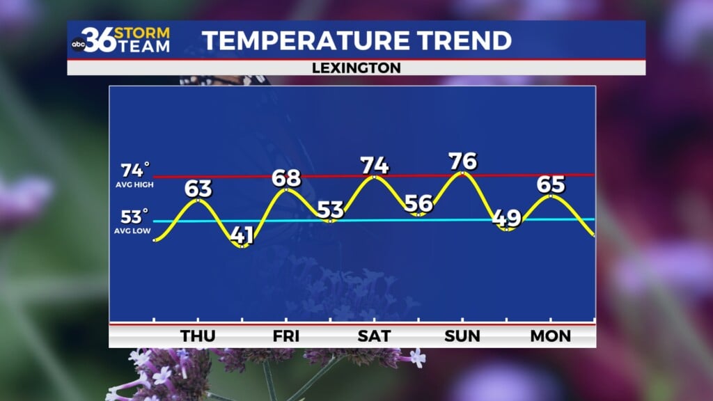
Looking toward the weekend, confidence in a completely dry forecast has dropped. Some forecast models are now suggesting an upper-level low may stall out over the Ohio or Tennessee Valley, which would keep daily rain chances around through Saturday, Sunday, and even into early next week. The European model has been consistent in this idea, while the American (GFS) model tries to clear the system out faster. Either way, the trend leans unsettled, and we’ll keep a close eye on it as we fine-tune the weekend details.
We’ll continue to monitor the latest data and adjust the forecast as needed — especially heading into the weekend when timing and coverage of rain will play a big role in outdoor plans. Stay with the ABC 36 Storm Team for updates throughout the week!


