Scattered showers and storms return Thursday afternoon
After a mainly dry start to the day, scattered showers and storms will begin to fire up during the midday
LEXINGTON, Ky. (ABC 36 NEWS NOW) – After a mild and mostly quiet start to our Thursday, rain chances will begin to ramp up again this afternoon across central and eastern Kentucky. A few spotty showers are already dotting the southern half of the state, but we’re not expecting widespread activity until later in the day.
While it won’t be a total washout this afternoon, scattered showers and a few thunderstorms will be possible—especially into the evening hours. The severe threat remains very low, but locally heavy downpours could cause some ponding on roadways or minor issues in poor drainage spots. Most of the area will stay below an inch of rain, but isolated heavier totals can’t be ruled out, particularly in southern and southeastern counties.
Friday: More Rain, Still Mild
Friday brings our highest rain chances of the week as another system slides in from the west. Showers and storms will become more widespread by late afternoon into the evening. No severe weather is expected at this time, but with a very moisture-rich atmosphere in place, some areas could once again pick up on locally heavy rainfall.
Expect rainfall totals to range from ½ inch to 1 inch across the region, with localized pockets nearing 2 inches if storms repeatedly track over the same areas. We’ll be keeping a close eye on that for any localized flooding concerns.
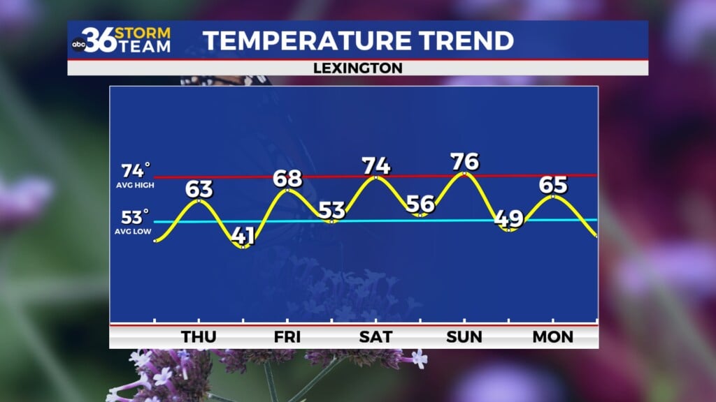
Despite the rain, temperatures will remain on the warm side—generally in the low to mid 70s through Friday.
Weekend Outlook: Cooling Down and Drying Out
A cold front will sweep through the region early Saturday, gradually pushing rain chances east and ushering in cooler, drier air. We may still see some lingering showers in the morning, especially in the eastern half of the state, but the second half of the day looks drier and cooler with highs only in the mid to upper 60s.
By Sunday, high pressure builds in and sets the stage for a beautiful end to the weekend. Expect mostly sunny skies and pleasant highs in the low to mid 70s.
Looking Ahead to Next Week
A warm-up begins Monday and Tuesday, with highs climbing into the upper 70s and low 80s. It’s not a stretch to think some spots could push the mid-80s by Tuesday afternoon!
Our next notable rain and storm chance arrives late Tuesday into Wednesday as a cold front approaches from the west. While any severe threat looks to stay mainly north and west of Kentucky, we’ll be watching closely for how that system evolves heading into the final days of April.


