Morning rain exits ahead of another round of showers and a few storms Thursday evening
You can expect a break from the rain to last through much of the daytime before rain chances increase Thursday evening
LEXINGTON, Ky. (ABC 36 NEWS NOW) – It was a soggy start to your Thursday across central and eastern Kentucky. Some hefty rainfall totals were already recorded this morning with Kentucky Mesonet sites in Bath, Clark, Fayette, and Franklin counties all picking up over half an inch. The steady line of moderate-to-heavy showers continues to push south and east and should exit the area by lunchtime.
Once the morning rain moves out, we’ll catch a break through the midday and afternoon hours. A few peeks of sun are possible, and that’ll help temperatures rebound into the upper 50s and low 60s — not a bad turnaround considering the gray start.
But don’t put the umbrella away just yet! Another round of scattered showers and a few thunderstorms will swing in later this evening and overnight. There is a low-end, isolated chance for a strong or severe storm during that time frame. The Storm Prediction Center has placed all of central and eastern Kentucky in a Level 1 Sever Risk (Marginal Risk) through tonight. The main concerns would be gusty winds and some hail in the strongest storms.
Looking Ahead: Cooler, Cloudy Friday – Weekend Rebound
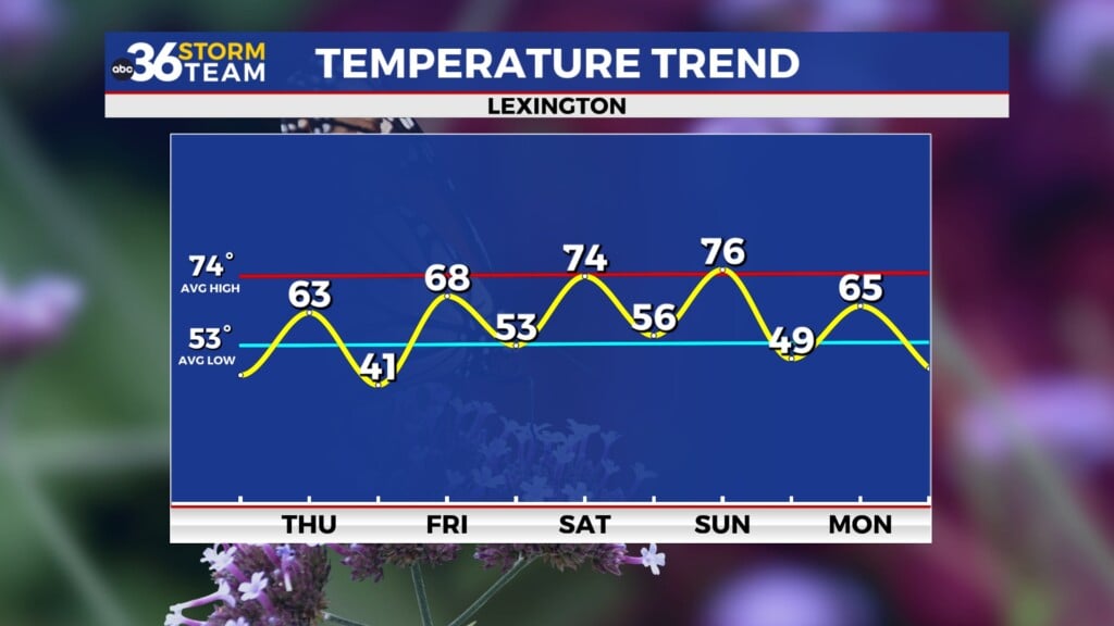
Showers will linger into Friday morning as that disturbance slowly exits the region. With clouds and a shift to northwest winds, temperatures will be cooler — starting in the 40s and only managing highs in the low 50s. Most of the rain wraps up by early afternoon, but clouds are likely to hang tough through much of the day.
Saturday will feel chilly to start with morning lows in the 30s and a stubborn overcast. However, by late day, skies should start to clear. Highs on Saturday stay cool, generally in the upper 50s to near 60.
By Sunday, we’ll be back into a warmer pattern. A warm front lifting through will boost afternoon highs into the low to mid 60s, and we’ll continue that warm-up into Monday with temperatures climbing into the low to mid 70s.
Another Storm Threat Early Next Week
We’ll need to keep a close eye on Monday afternoon into Monday night, as a cold front approaches from the northwest. The Storm Prediction Center has already included the northern half of Kentucky in their Extended Severe Outlook, meaning there’s potential for strong-to-severe storms as that front rolls through.
While details are still developing, models show decent instability and wind shear — conditions that could support damaging winds and possibly large hail. We’ll be monitoring this system closely in the days ahead.


