Heavy rain on the way late Thursday into early Friday
Meteorologist Dillon Gaudet has the latest in your full ABC 36 Storm Team forecast
LEXINGTON, Ky. (ABC 36 NEWS NOW) – It’s a cold and quiet start to your Thursday, but big changes are on the way as heavy rain moves in later today and into the overnight hours. Here’s what you need to know to plan your day and the days ahead:
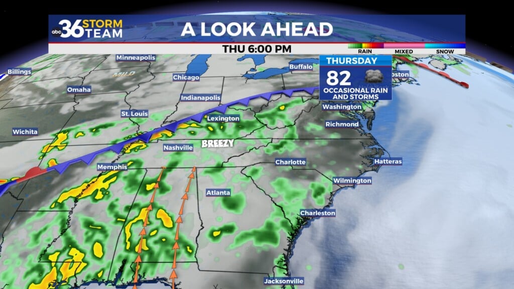
Thursday: Rain Develops, Heavy at Times Overnight
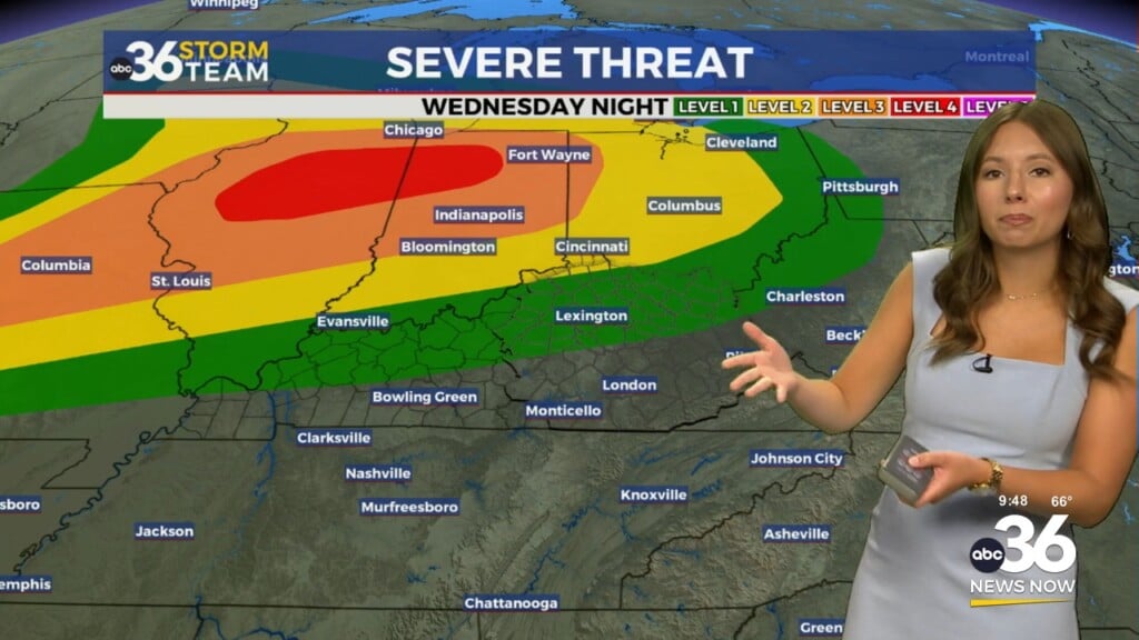
This morning kicks off with dry conditions and increasing cloud cover as a large low-pressure system approaches from the west. Rain will start spreading into the area by early afternoon, becoming more widespread through the evening hours. Expect steady rain overnight, with rainfall totals ranging from 1 to 2 inches across the region, and locally higher amounts possible, particularly across central Kentucky.
Flooding is not expected to be widespread, but isolated issues could develop in low-lying or flood-prone areas, so be mindful of standing water, especially during the overnight and early morning hours.
Friday: A Wet Morning, Breezy and Mild Afternoon with Showers Possible
Rain will taper off from west to east Friday morning as the heavy rain shifts eastward. By late morning into the midday hours, skies will begin to clear for central Kentucky, allowing a strong southwesterly breeze to take over. This will boost temperatures into the upper 50s and low 60s for the afternoon—a spring-like feel for late January!
However, we’re not completely done with the rain. Isolated-to-scattered rain showers and even a few thunderstorms will develop during the late afternoon and early evening as the upper-level trough swings through. Any storms are expected to be short-lived with minimal impact, but keep an umbrella handy if you’re out and about.
Saturday: A Cooler but Quiet Day
As the storm system departs, we’ll see a return to dry weather Saturday morning. Temperatures will cool slightly with highs only reaching the mid-to-upper 40s under partly cloudy skies. A few early showers may linger before clearing completely.
Sunday and Beyond: Warming Up Again Before Another Cooldown
The cooldown will be brief as warmer air surges back in Sunday and Monday. Highs on Sunday will climb into the low-to-mid 60s, continuing into Monday. Dry weather will dominate through this period, making for a pleasant end to the weekend and start to the new week.
By Tuesday, another system will bring cooler temperatures, with highs dropping back into the upper 40s to low 50s. Rain chances will return midweek as we transition into a more active weather pattern heading into February.
Weather Impacts
- Flooding Concerns: Be cautious of isolated localized flooding, particularly in low-lying or poorly drained areas. Avoid driving through standing water.
- Breezy Friday: Winds could gust over 20-30 mph during the afternoon. Secure any outdoor items that could blow away.
- Weekend Outdoor Plans: Saturday will be cooler but dry, while Sunday offers mild and pleasant weather. Great for any outdoor activities!
Stay with the ABC 36 Storm Team for more updates.