Rain and storms move in Thursday
Meteorologist Dillon Gaudet has the latest in your full ABC 36 Storm Team forecast
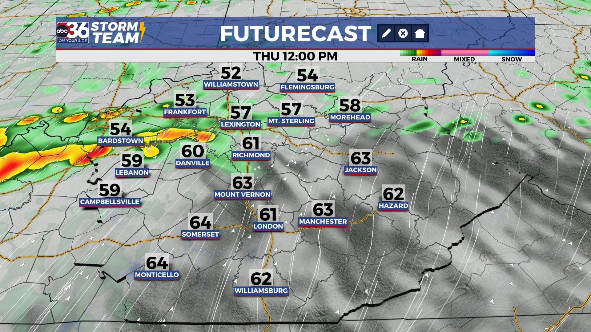
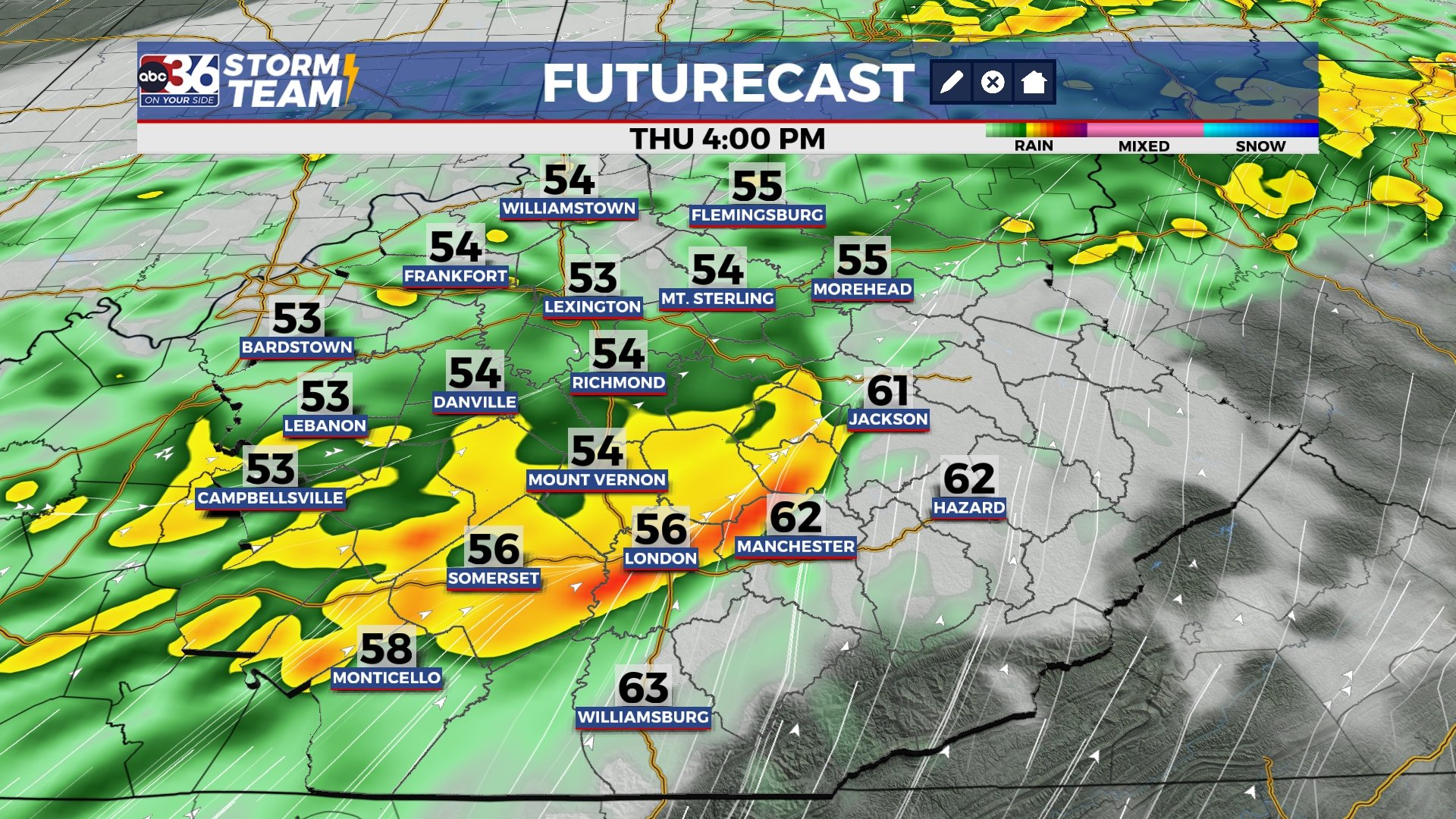
Happy Thursday! It’s a breezy and mild start to the day but don’t forget your rain jacket because rain arrives during the second half of the day.

Rain is likely this afternoon through the evening hours, with a few storms possible. A widespread half inch to an inch of rain is possible, with locally higher amounts possible within the heavier downpours. Be alert for rising creeks and stream in low-lying and flood prone areas later this evening within the heavier downpours.
This rain exits tonight and gives way to a slightly cooler day on Friday. Afternoon highs Friday will reach the low-to-mid 50s with a few morning sprinkles possible in eastern Kentucky.

We are tracking a brief shot of wintry weather on Saturday. A quick moving system will pass through the Ohio River Valley late Friday night into Saturday morning. This will give central and eastern Kentucky a quick burst of some light snow and/or a rain snow mix Saturday morning. Temperatures on Saturday likely won’t get out of the 30s, reaching the mid-to-upper 30s for most.

Did I mention it was brief? Because we are right back to the upper 50s on Sunday and that leads to a spring-like pattern into next week. Temperatures soar back to the 60s Monday through Wednesday, with upper 60s near 70 degrees possible. This warmer pattern will lead to spring-like thunderstorms. The Storm Prediction Center is already highlighting most of Kentucky for a strong-to-severe storm threat next Wednesday. This is ahead of a strong cold front that will likely briefly drop out temperatures once again to end next week.

Stay with the ABC 36 Storm Team for more updates.
ABC 36 HOUR FORECAST
THURSDAY: Rain and storms likely. Highs in the upper 50s. Wind gusts upwards of 30-40 mph possible.
THURSDAY NIGHT: Rain and storms early, mostly cloudy late. Lows in the upper 30s and low 40s.
FRIDAY: Mostly-to-partly cloudy. Highs in the low-to-mid 50s.