Summer-like feel continues ahead of a big weekend cooldown
Meteorologist Dillon Gaudet has the latest in your ABC 36 Storm Team forecast
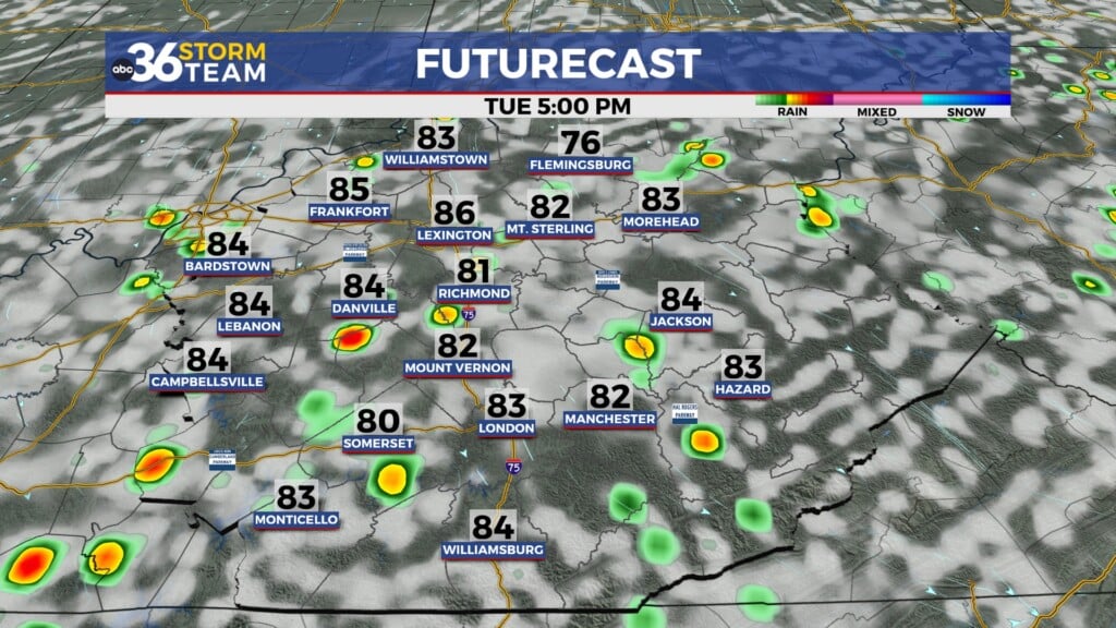
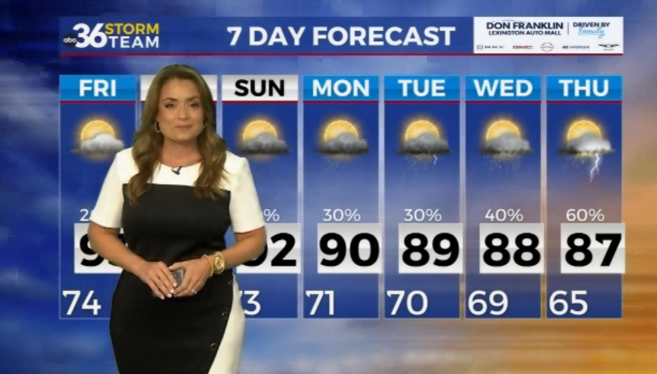
A summer-like feel continues through the middle of the workweek. Afternoon highs on Tuesday and Wednesday will be reaching the mid-80s for most, with some upper 80s possible. Sunny skies continue for Tuesday as well, though Wednesday will feature a few more clouds.

However, don’t get too comfortable with these conditions. A strong cold front will be pushing through the region on Friday that will plummet our temperatures by the weekend. Afternoon highs on Saturday and Sunday will struggle to even reach the low 60s! Morning lows on Sunday will be dipping into the upper 30s with patchy frost possible for some. There is still a bit of uncertainty around how low morning temperatures will drop. Clearer skies Sunday and Monday morning will allow temperatures to drop into the upper 30s. If there is still cloud cover around, less areas will fall into the 30s. Regardless of the technicalities, it will still be a chilly weekend region-wide.

Ahead of the drop in temperatures we will see scattered showers and a few thunderstorms late Thursday into Friday. Heavy rainfall isn’t expected, but there will be region-wide rainfall. Totals will stay generally on the lower end so this won’t be improving drought conditions across the region. With dry conditions expected to continue through at least the middle of the month, expect low-end drought conditions to continue. Stay with the ABC 36 Storm Team for more updates.


The ABC 36 Storm Team is on your side.
ABC 36 HOUR FORECAST
TUESDAY: Mostly sunny and very warm. Highs in the mid-to-upper 80s.
TUESDAY NIGHT: Mostly clear skies. Lows in the upper 50s and low 60s.
WEDNESDAY:Partly cloud skies and warm. Highs in the mid-80s.