Our steamy and stormy pattern continues
Meteorologist Jordan Smith has a look at your Friday morning forecast!
Lexington, Kentucky (WTVQ – ABC 36): Good Friday everyone, we have a mainly dry and hot day in store across central and eastern Kentucky. Temperatures this afternoon hit the upper 80s to low 90s with heat index values into the mid to upper 90s. Skies will be partly to mostly sunny as well with only a very slight shower/storm chance.


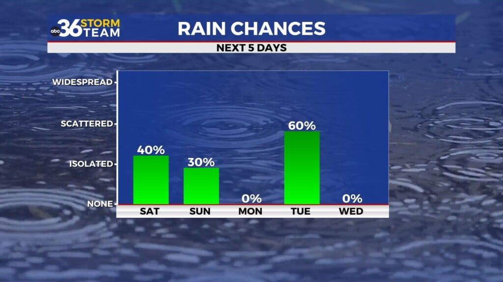
Heading into Saturday we will up the storm chance with scattered showers and storms becoming likely during the afternoon and evening.

A few of those storms can be strong to locally severe as well with a “MARGINAL” risk (level 1/5) out for our entire area. Damaging winds, heavy rain, frequent lightning, and small hail are our main concerns.

Heavy rain can lead to some high water issues and the future cast rainfall totals show pockets of very heavy rain setting up which could lead to a local flash flood threat.

Sunday looks mainly dry and hot again with temperatures into the mid to upper 80s.

Next week will feature a daily chance for rain and storms once again as our stormy pattern rolls on. But that does not mean it will rain every day at your house and no day is a wash out, but you’ll want to have a back up plan for any outdoor activities. It is all apart of a pattern that has an area of low pressure to our north and moisture streaming in to the south of it. That puts us here in Kentucky for the greatest storm chance.

As always, stay with the ABC 36 Storm Team on-air and online for updates! #kywx
Back here in the short term…
TODAY:

TONIGHT: