Brief warm-up ahead of Friday rain
Meteorologist Dillon Gaudet has the latest in your ABC 36 Storm Team forecast
Wednesday morning temperatures dropped into the upper teens and low 20s. Good news is that temps will recover into the upper 40s and low 50s by the afternoon. Sunny skies are on the way all day long as well. Overnight lows will return to the low 30s and upper 20s in the eastern Kentucky valleys.
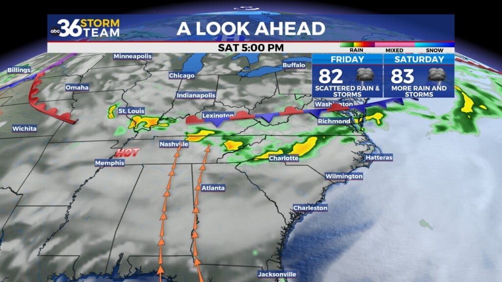
Our Go Day of the week is Thursday as temperatures return to the upper 50s and low 60s. Enjoy it though because the mild air is short lived. Clouds will increase late Thursday ahead of a system that will move through on Friday. Gusty winds and rain showers begin during the early morning hours Friday and will last off and on through much of the day. Wind gusts upwards of 40-50 mph will be possible. Rainfall amounts should stay minimal, with the central and eastern Kentucky avoiding heaviest of the rain.
Temperatures will be dropping during the day on Friday, setting the stage for another chilly weekend. Temps Saturday and Sunday will struggle to reach low 40s and will drop into the 20s both mornings. However, the weekend is looking dry at least outside of a flurry chance late Friday into early Sunday.
The ABC 36 Storm Team is on your side.
ABC 36 HOUR FORECAST
WENESDAY: Cold start with lots of . Highs in the low 50s.
WEDNESDAY NIGHT: Mostly clear and chilly. Lows in the low 30s.
THURSDAY: Clouds increase. Highs in the low 60s.