Sunshine and comfortable weather return to close out the weekend
After widespread rain on Saturday, the system responsible for the activity weather will move southeast on Sunday, allowing for the return of sunshine and comfortable temperatures.
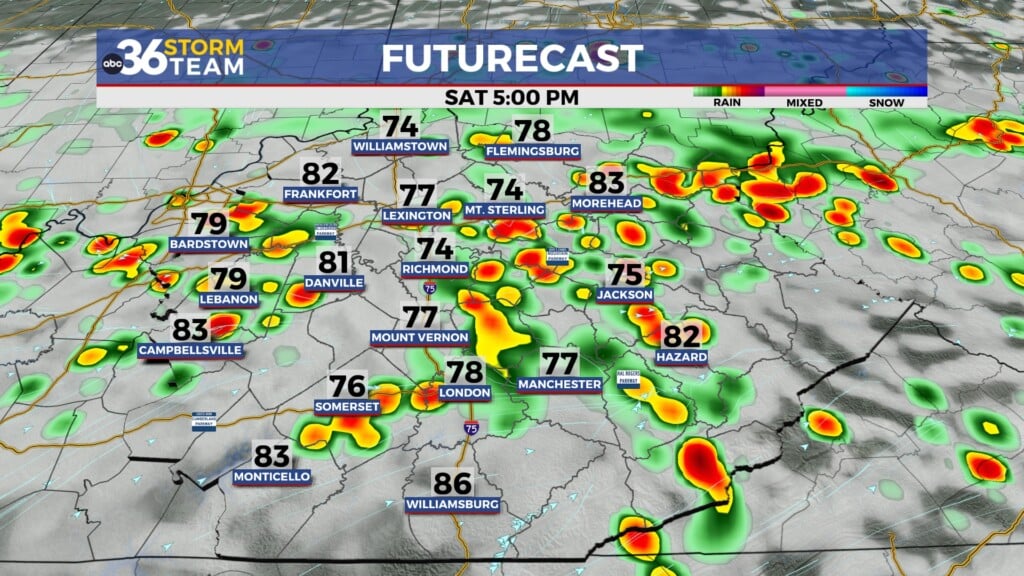
Saturday brought parts of Central Kentucky the most widespread rain the area has seen in some time. While it won’t eliminate the drought, the rain was much appreciated and should put a dent in our rainfall deficit. Doppler radar estimates half an inch of rainfall or more fell across the region the past 24 hours.

The low-pressure system and associated frontal boundary that brought the unsettled weather will continue to slide south and east, allowing the return of plenty of sunshine and comfortable temperatures on Sunday. Expect highs to reach the mid-80s.

Heat and humidity will creep back in early next week as a ridge of high pressure builds. High temperatures Monday and Tuesday are expected to reach the low 90s with a sticky feeling in the air.

The hot weather is short-lived as another cold front is set to move in Tuesday night. Near and ahead of this front, isolated showers and thunderstorms will be possible, but we won’t have much moisture to work with, so don’t expect widespread activity.

The rest of the week looks fantastic, with mostly clear skies and temperatures in the mid to upper- 80s.

ABC 36 HOUR FORECAST
SATURDAY NIGHT: Showers early, clearing late. Lows in the mid 60s.
SUNDAY: Mostly sunny and very pleasant. Highs in the mid 80s.
SUNDAY NIGHT: Mostly clear, patchy fog late. Lows in the mid 60s.